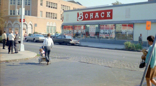
Television is the first audiovisual device that changed the way people see entertainment. It opened the realm of recreation and mass communication. It made possible for people and families to watch live events in the comforts of their drawing room. By 1950s, the aftermath of World War II had faded away. Economy was booming again and people had cash in their wallets. Prosperity was returning to America.
That’s the reason why the decade of the 1950s is also known as ‘The Golden Age of Television’. Even though, television broadcasting had been active since the 1930s, it was only in the 1950s that it actually caught people’s fancy.
It was in the 1950s, when the television started influencing the lives of the common men. Also according to a survey, approximately 3.1 million people had television sets in America in the 1950s.
To attract buyers, there were many interesting ads that launched in this decade. And these are some of them.
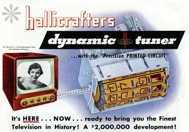
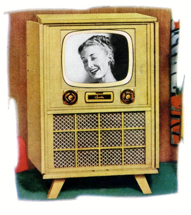
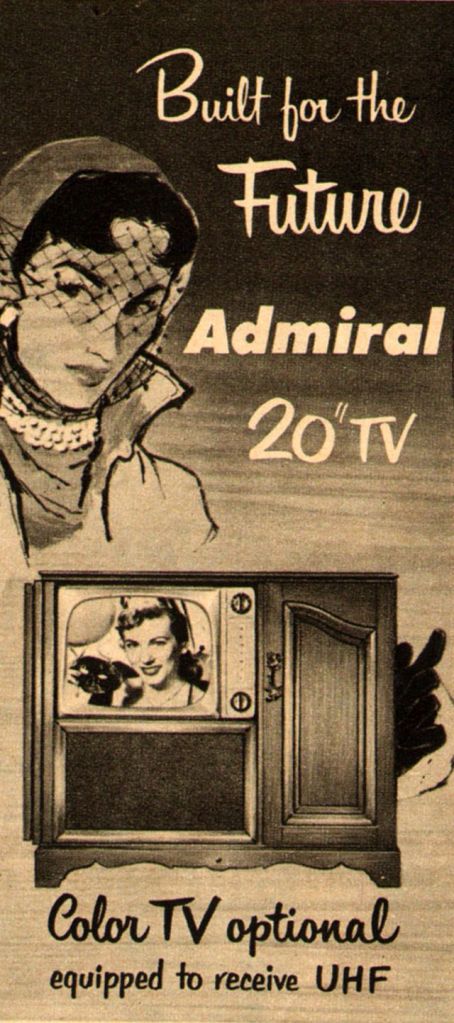
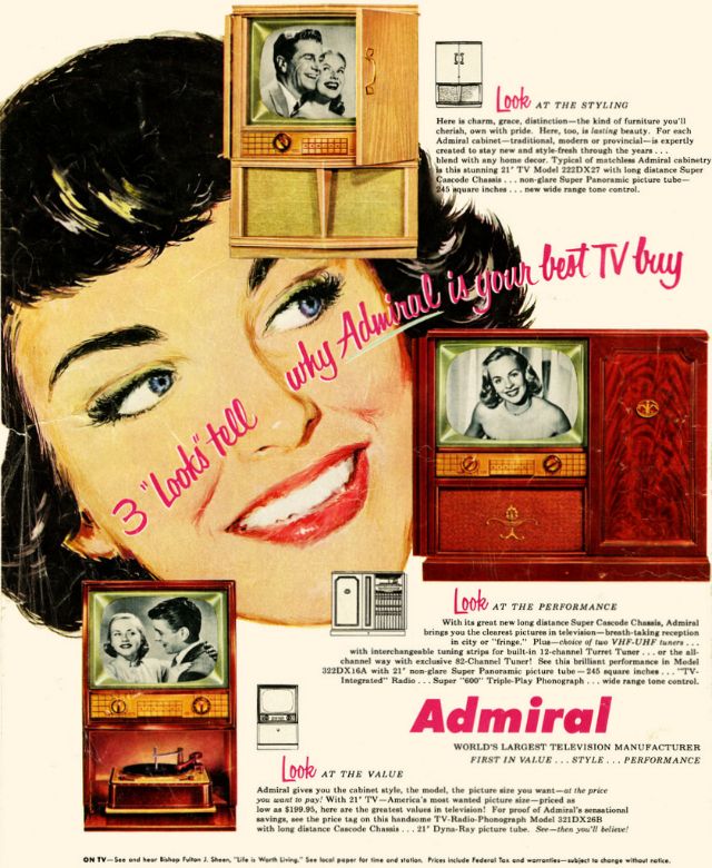
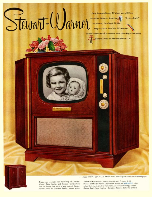
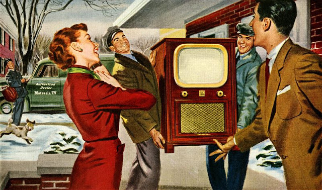
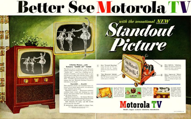
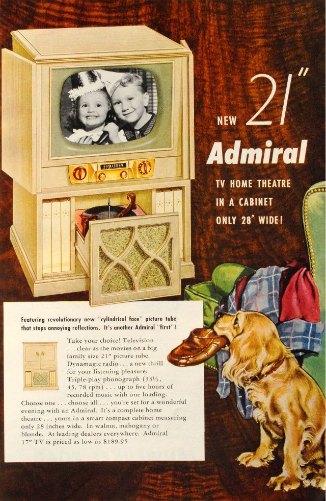
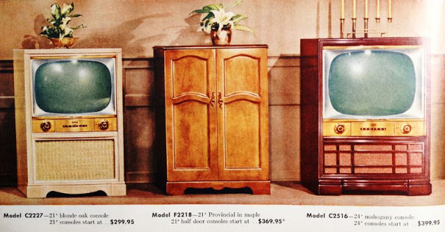
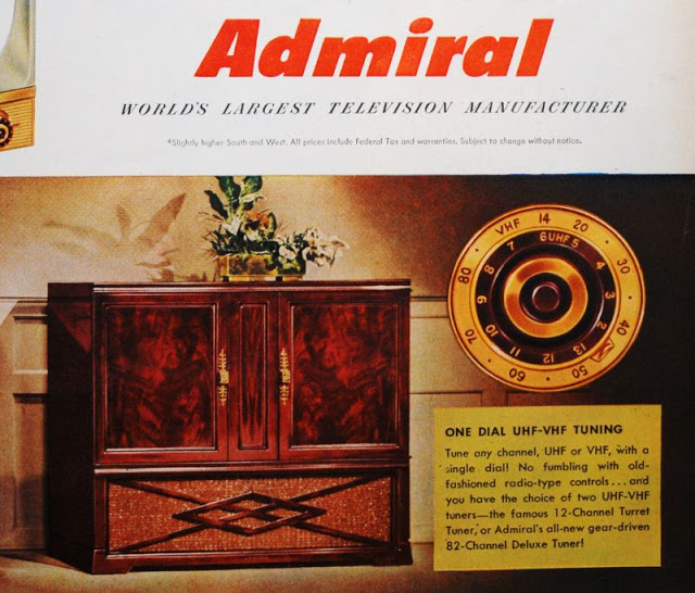
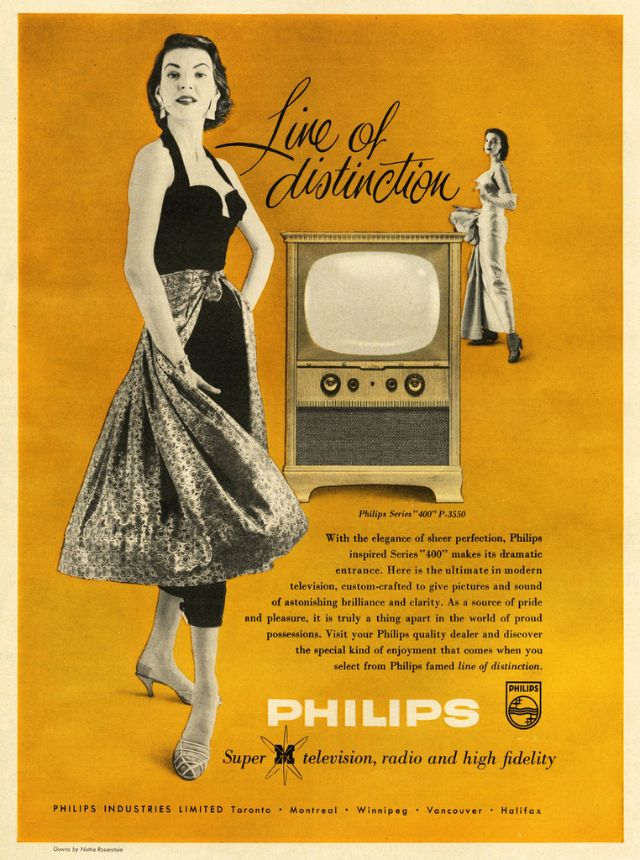
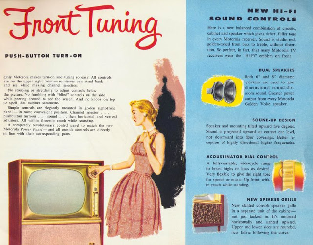
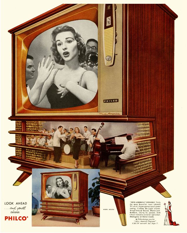
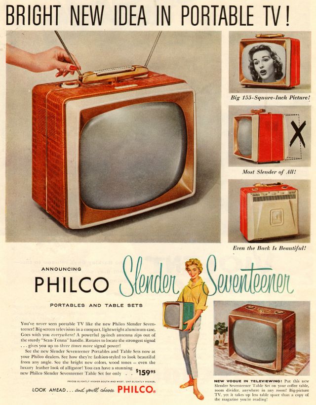
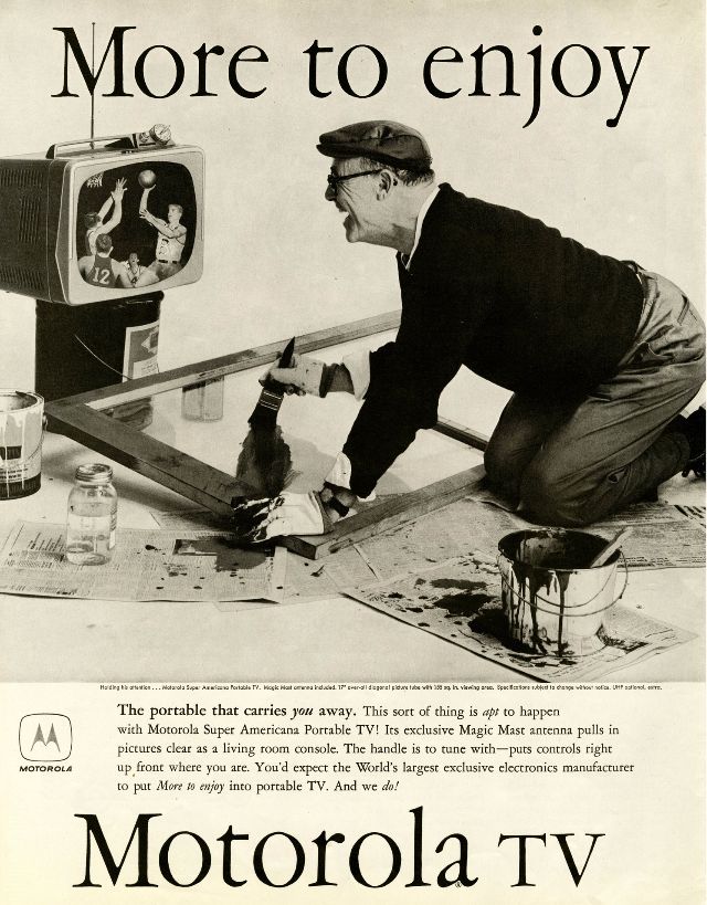
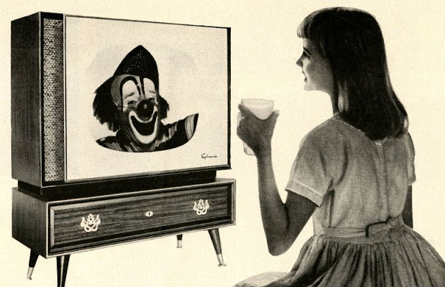
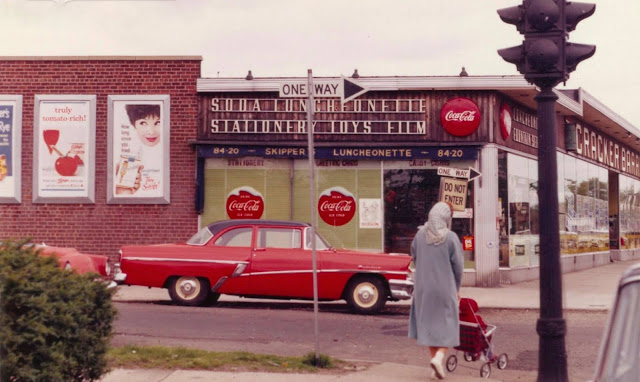
Hallicrafter’s Dynamic Tuner, 1950Capehart Television, 1950IT&T’s New Amsterdam Television, 1950Motorola Television, 1950A 1951 17-Inch Sparton Del-Mar, 1951Admiral Television, 1951Crosley Family Theatre Television, 1951Dramatic New Zenith Television, 1951Emerson TV, 1951Motorola TV, 1951Philips TV, 1951Stewart-Warner TV, 1951Zenith Black Magic Television, 1951A television brings unlimited joy to every household, Motorola TV, 1952Motorola TV, 1952New 21″ Admiral TV, 19523 “looks” tell why Admiral is your best TV buy, 1953Admiral TV series, 1953Admiral TV series, 1953Admiral TV, 1953Spartan Cosmic Eye Television, 1953 Stromberg-Carlson Television with Thrilling Panoramic Vision, 1954General Electric Television, 1955Philips Series “400” P-3550, Line Of Distinction, 1955Zenith Television, 1955Crosley Television, 1956Motorola Color TV Console, 1956Motorola Color TV with finest picture, finest sound, 1956Motorola Front Tuning, 1956The Fine New Motorola TV, 1956Miss America Philco TV, 1957Philco Announces Hyper-Power Television, 1957Philco Slender Seventeener television set, 1957Motorola TV, 1958Sylvania HaloLight Television, 1959
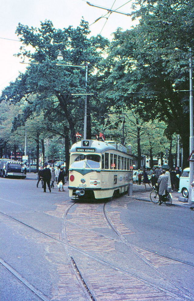
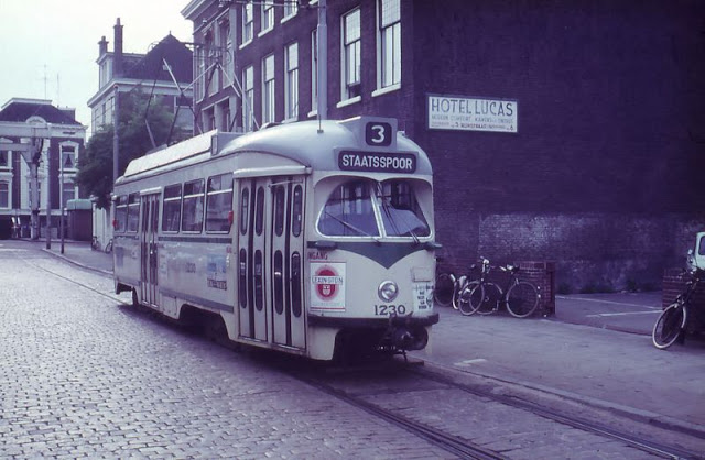
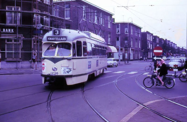
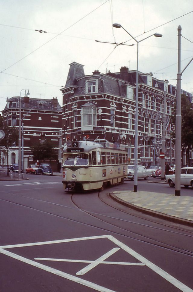
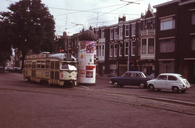
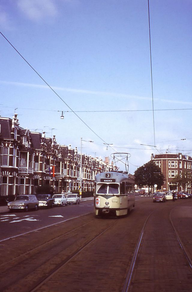
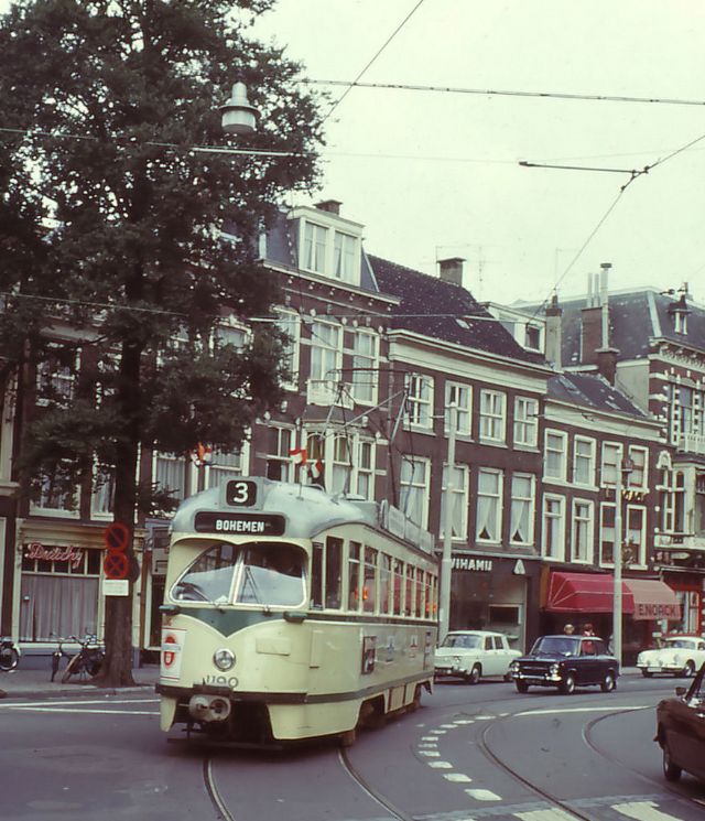
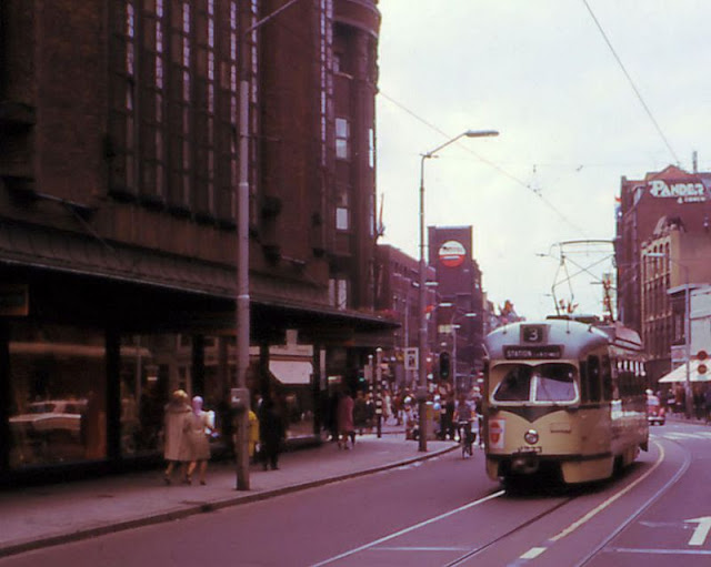
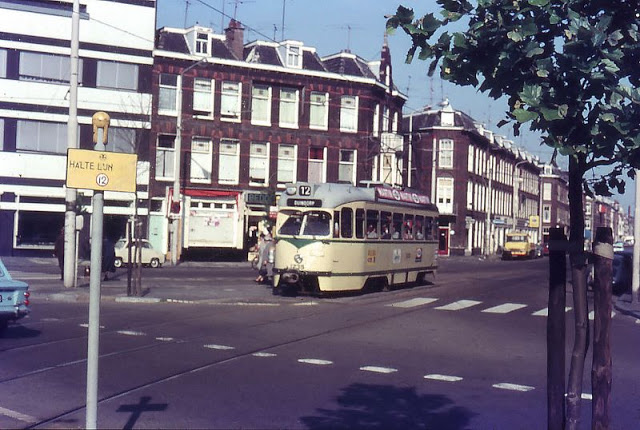
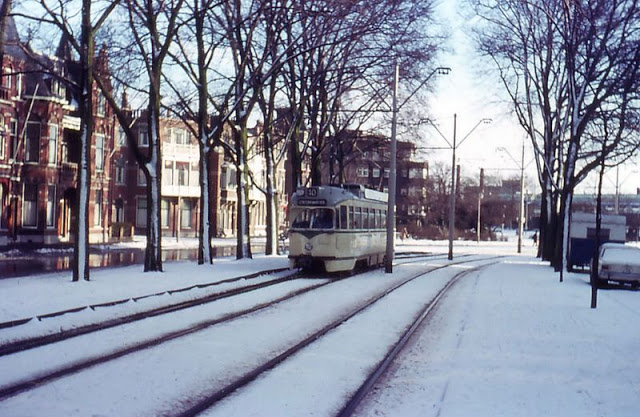
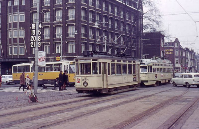
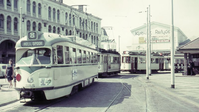
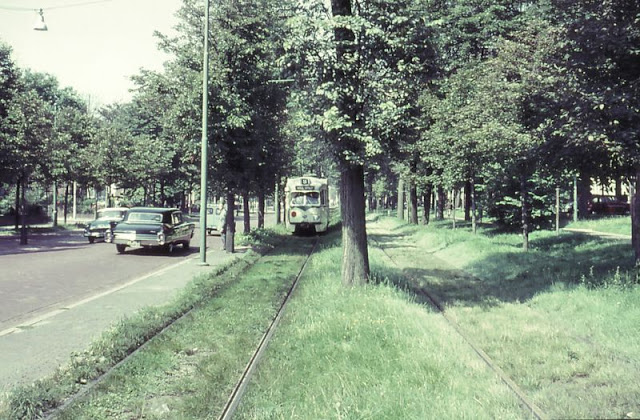
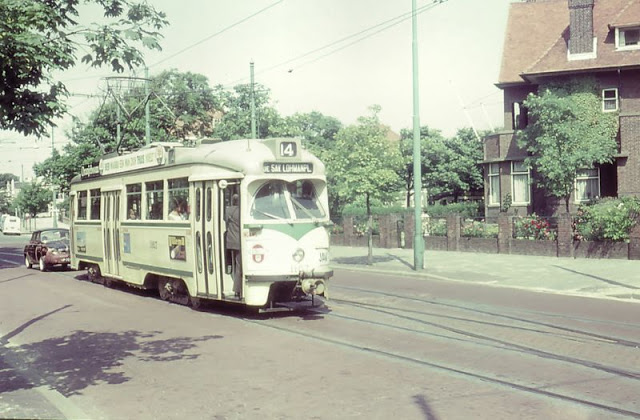
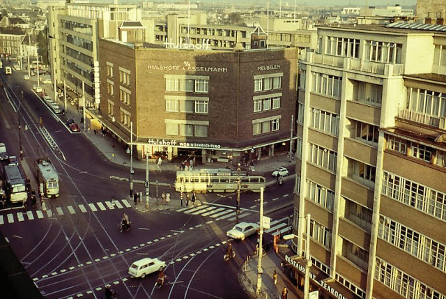
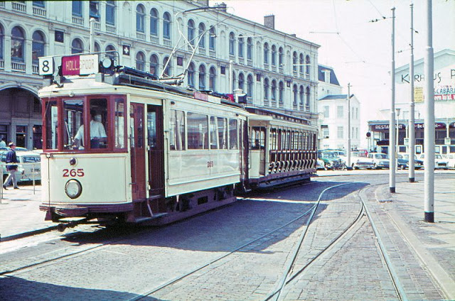
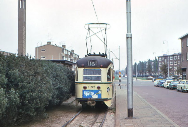
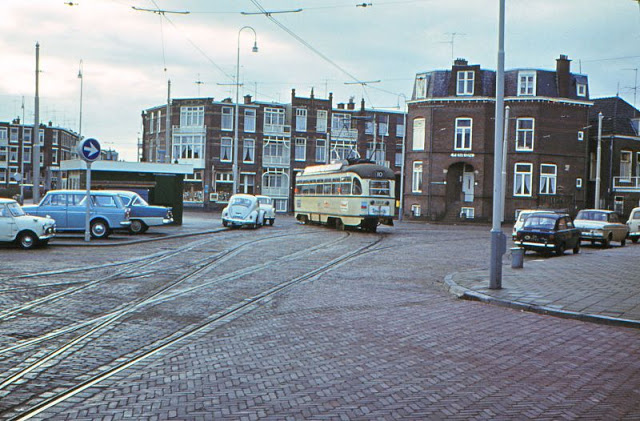
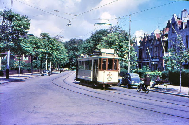
The Hague is a city and municipality of the Netherlands, situated on the western coast facing the North Sea. It is the administrative and royal capital of the Netherlands and its seat of government, as well as the capital of the province of South Holland. It hosts the International Court of Justice and International Criminal Court.
With a population of over half a million, it is the third-largest city in the Netherlands, after Amsterdam and Rotterdam. The Hague is the core municipality of the Greater The Hague urban area, which comprises the city itself and its suburban municipalities, containing over 800,000 people, making it the third-largest urban area in the Netherlands, again after the urban areas of Amsterdam and Rotterdam. The Rotterdam–The Hague metropolitan area, with a population of approximately 2.6 million, is one of the largest metropolitan areas in Europe and the most populous in the country; the area holds the Rotterdam The Hague Airport. Situated on the west coast of the Netherlands, The Hague lies at the southwest corner of the larger Randstad conurbation, one of the largest conurbations in Europe.
The Hague is the seat of the Cabinet, the States General, the Supreme Court and the Council of State of the Netherlands, but the city is not the constitutional capital, which is Amsterdam. King Willem-Alexander lives in the Huis ten Bosch and works at the Noordeinde Palace in The Hague, together with Queen Máxima. Most foreign embassies in the Netherlands are located in the city. The Hague is also home to the headquarters of many Dutch companies, with Shell plc having major offices in the city as well.
The Hague is known as the home of international law and arbitration. The International Court of Justice, the main judicial arm of the United Nations, is located in the city, as are the International Criminal Court, the Permanent Court of Arbitration, the Organisation for the Prohibition of Chemical Weapons, Europol, and approximately 200 other international governmental organizations. (Wikipedia)
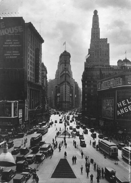
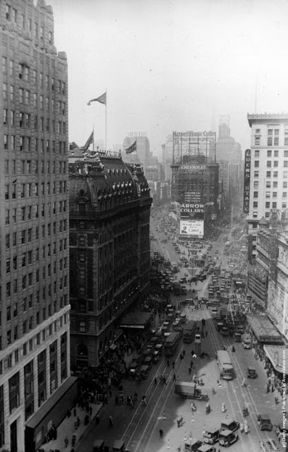
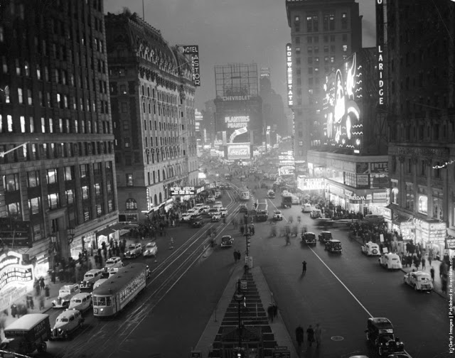
Formerly known as Longacre Square, Times Square was renamed in 1904 after The New York Times moved its headquarters to the newly erected Times Building – now One Times Square – the site of the annual New Year’s Eve ball drop which began on December 31, 1907, and continues today, attracting over a million visitors to Times Square every year.
The general atmosphere of Times Square changed with the onset of the Great Depression in the early 1930s. City residents moved uptown to cheaper neighborhoods, and many popular theaters closed, replaced by saloons, brothels, “burlesque halls, vaudeville stages, and dime houses.” The area acquired a reputation as a dangerous and seedy neighborhood in the following decades.
Nevertheless, Times Square continued to be the site of the annual ball drop on New Year’s Eve. The ball drop was placed on hiatus for New Year’s Eve in 1942 and 1943 due to lighting restrictions during World War II. Instead, a moment of silence was observed at midnight in Times Square, accompanied by the sound of chimes played from sound trucks.
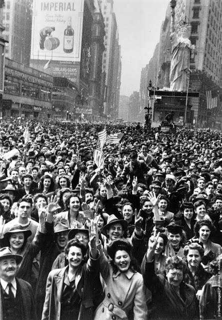
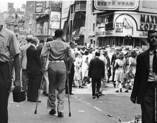
On May 8, 1945, a massive crowd celebrated Victory in Europe Day in Times Square; and on August 15, 1945, the largest crowd in the history of Times Square gathered to celebrate Victory over Japan Day. The victory itself was announced by a headline on the “zipper” news ticker at One Times Square, which read “*** OFFICIAL TRUMAN ANNOUNCES JAPANESE SURRENDER ***”, the six asterisks representing the branches of the U.S. Armed Forces.
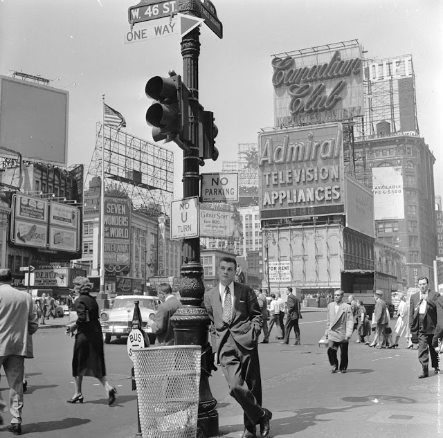
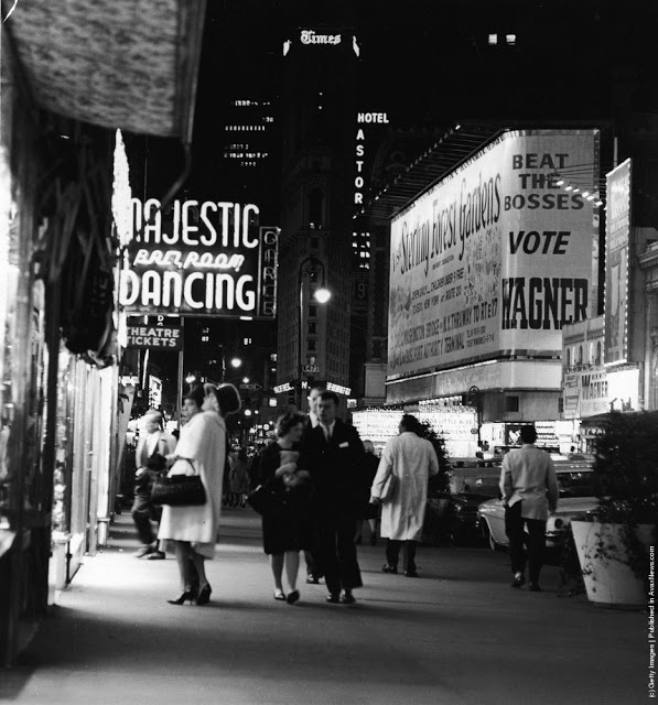
Brightly adorned with billboards and advertisements, Times Square is sometimes referred to as “The Crossroads of the World”, “The Center of the Universe”, “the heart of The Great White Way”, and the “heart of the world”.
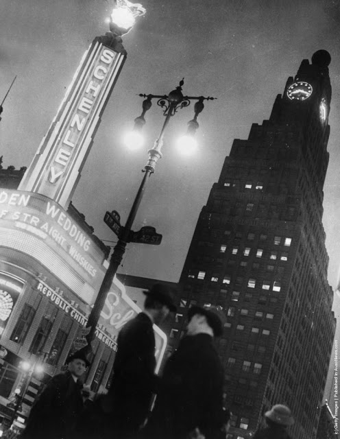
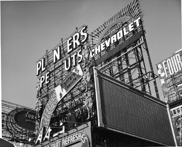
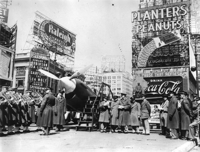
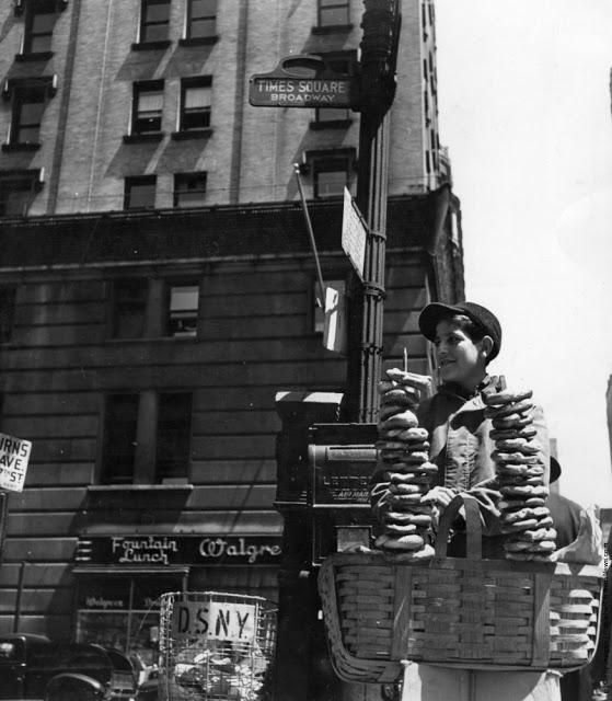
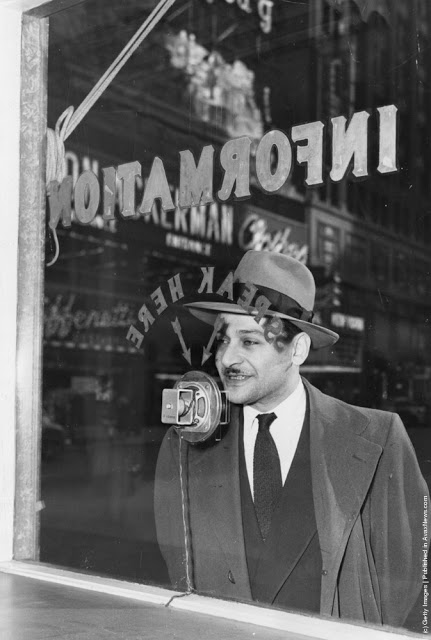
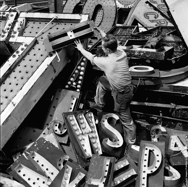
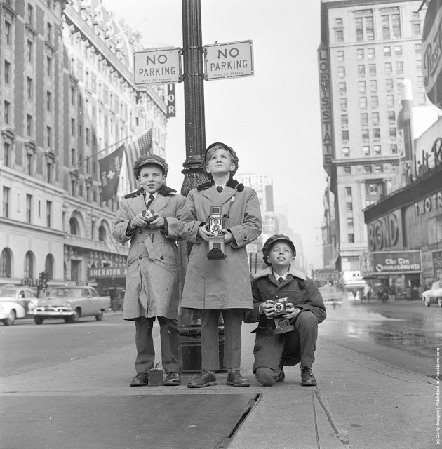
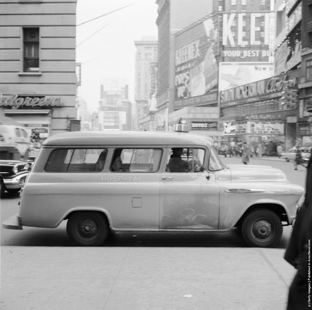
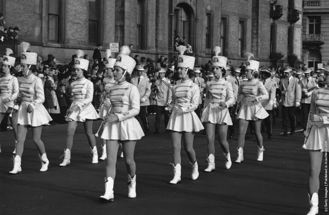
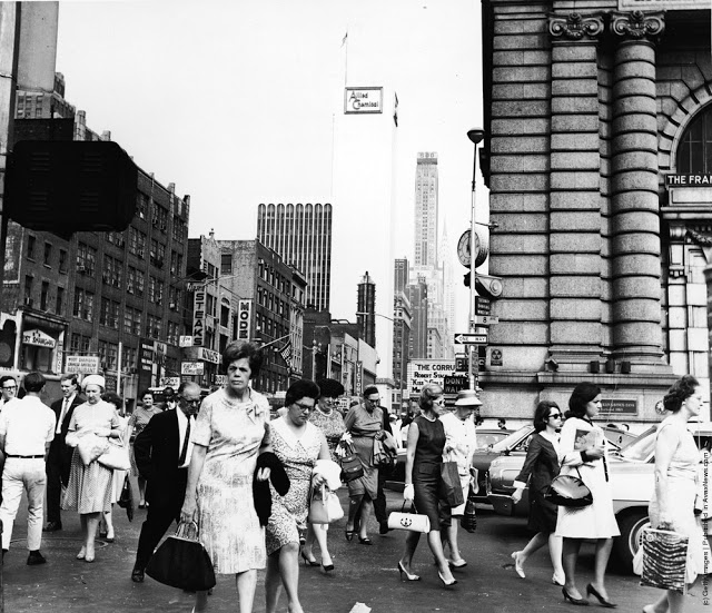
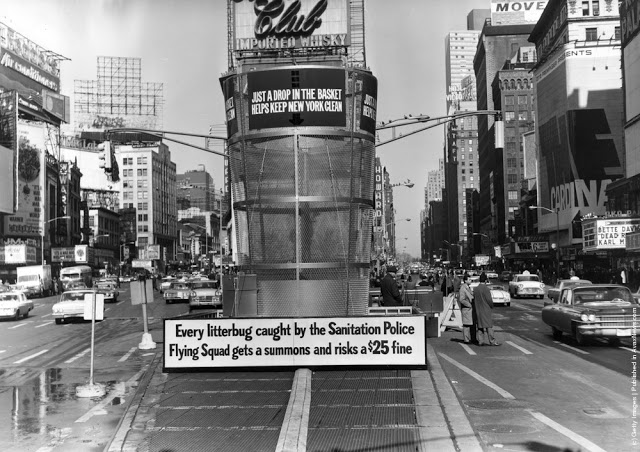
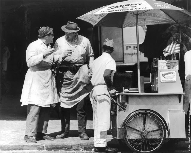
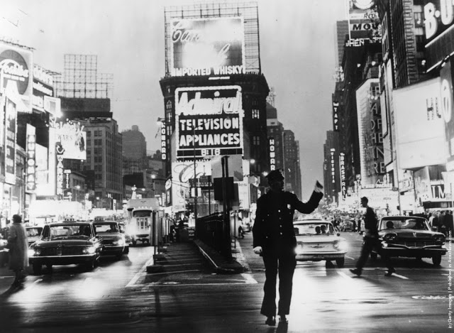
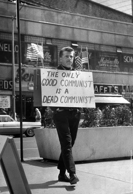
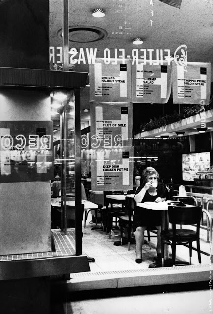
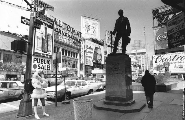
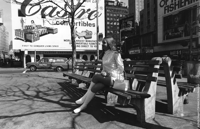
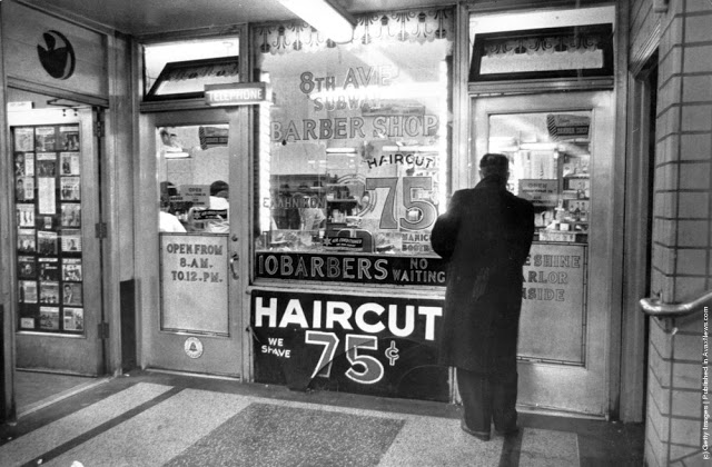
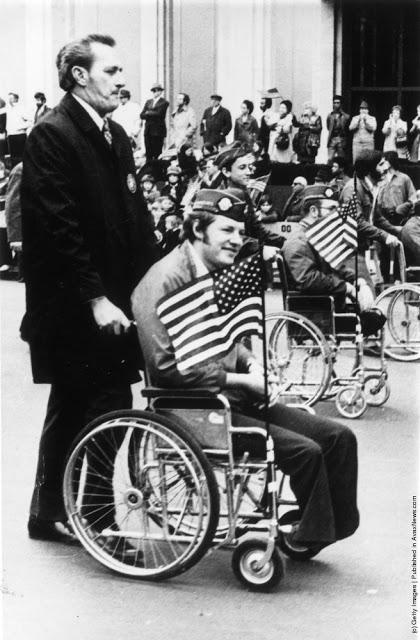
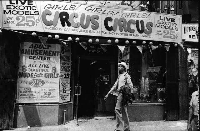
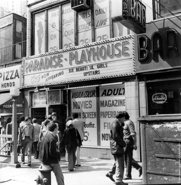
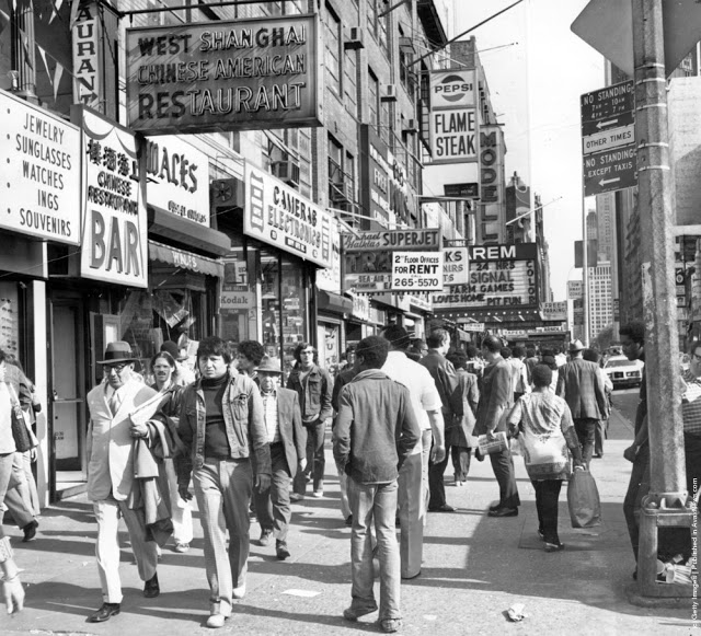
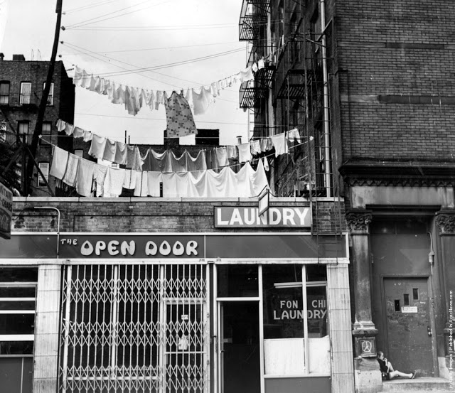
Looking towards the Times Building on Times Square, the Paramount Building is on the right, and Seventh Avenue on the left crossing Broadway, 1930.Broadway looking towards Times Square in New York. 8th February 1934.Paramount Building in Times Square, New York, towers over Schenleys Chinese Restaurant, 1936.An overhead view of Times Square at night, New York City, New York, 1937.A view of the Planters Peanuts illuminated sign at the intersection of Broadway and 7th Avenue, Times Square, New York City, New York, 1940.A military band and a Curtiss P-40 Army Pursuit plane in Duffy Square on the corner of Times Square in New York. The plane is part of an exhibition to encourage men to join the Army Air Corps. 10th April 1941.Crowds celebrate VE day in Times Square, New York. 8th May 1945.A rear veiw of a soldier on crutches in a crowd in Times Square on VJ Day, New York City, August 1945.A pretzel vendor selling his wares from a wicker basket in the Times Square and Broadway area of New York, 1947.An information seeker speaks into a microphone at a police information booth at Times Square, New York. 14th March 1949.Old signs reclaimed by neon sign making company Art-Craft Strauss, circa 1950. Many of their signs adorn New Yorks Times Square.A salesman bides his time in Times Square, Manhattan, New York, 1950.A night street scene at 47th Street near Times Square, showing night club and theater signs, New York City, New York, 1958.Choristers from a Norwegian choir on a visit to New York take photographs in Times Square, 1956.A Beth David Hospital ambulance on call in Times Square, 1956.A group of majorettes parading in the Thanksgiving Parade near Times Square, New York. 26th November 1961.Crowds of pedestrians walk at the intersection of Eighth Avenue and 42nd Street, with the Allied Chemical building visible in the background, New York City, 1962.A gigantic litter basket in Times Square, New York with a sign saying, [Just a Drop in the basket keeps New York Clean]. Another signe threatens a 25 fine for any litterbug caught by the Sanitation Police Flying sqaud. 18th March 1964.Two butchers stop to chat after buying hot dogs from a street vendor in the Times Square area of New York, 1965.A policeman directs traffic in front of the famous neon billboards of Times Square in New York City, at its intersection with Broadway, 1965New York nightclub owner Jack L Hickman spends his free time marching around Times Square with a sign that reads [The only good communist is a dead communist]. 26th April 1965.A woman sitting in a Times Square cafeteria, New York, 1968.Times Square, New York with the statue of theatrical impresario, George Cohan being studied by a fur coated, mini-skirted passer-by, 1969.Actress Linda Hayden on a bench in Times Square, New York, 1969.A man entering a barber shop under Times Square, New York, 1969.Two amputees take part in a parade through Times Square in New York City, to commemorate the end of the Vietnam War and honour those who took part in it. 6th April 1973.Exterior view of Circus Circus, an [adult amusement center], in Times Square as a man walks past wearing a hat and carrying his coat over his arm, New York, New York, 1975. The marquee advertises exotic models, nude girls, books, magazines, games, and peep shows, as well as a juice bar and [high-potency protein health drinks].A porn shop with films and live shows near Times Square, New York, 1975.Shoppers on West 42nd Street between 7th and 8th Avenues in the Times Square area of New York. 12th October 1975.Clean washing hanging out to dry above a laundry one block west of the more glamorous Times Square, New York, 1977.
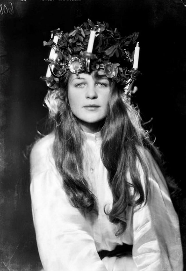
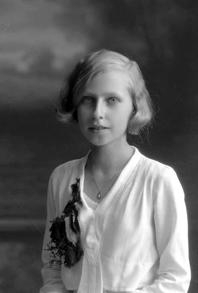
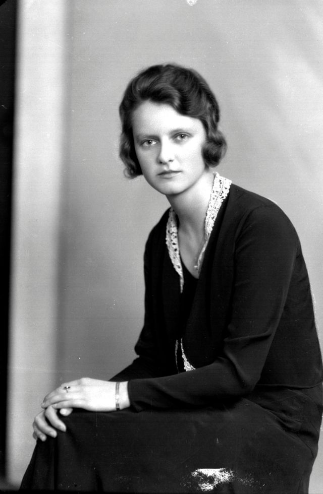
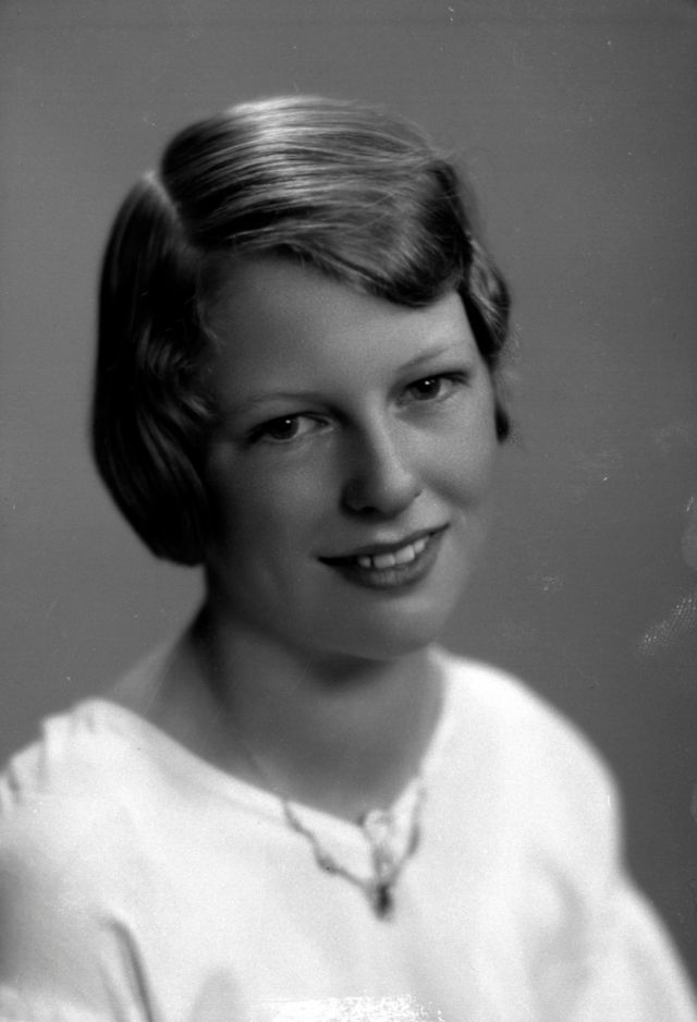
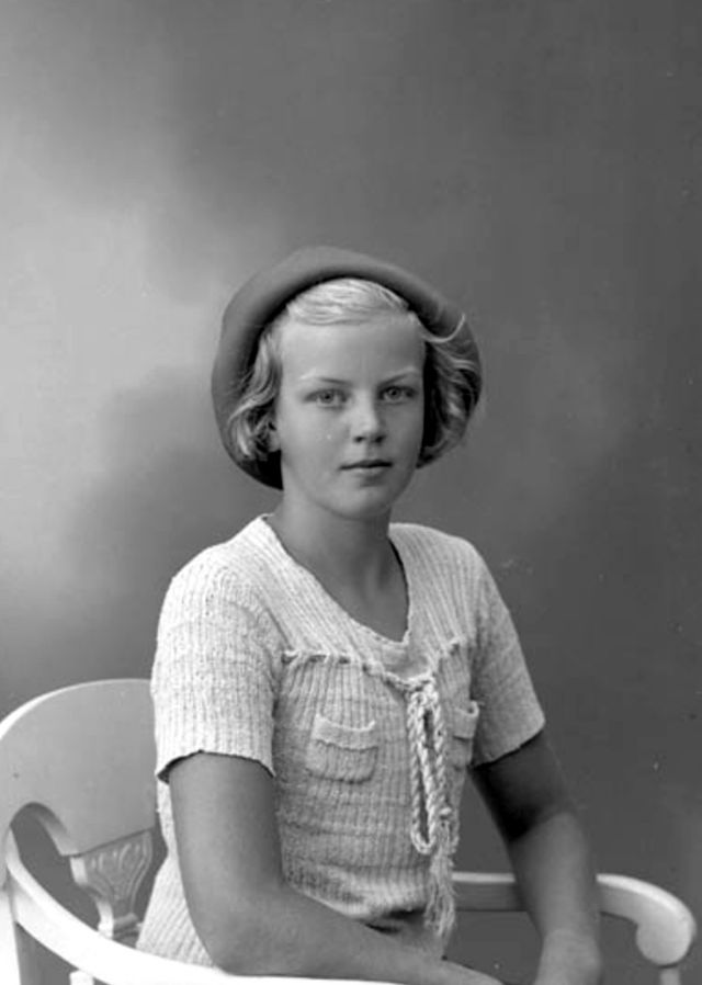
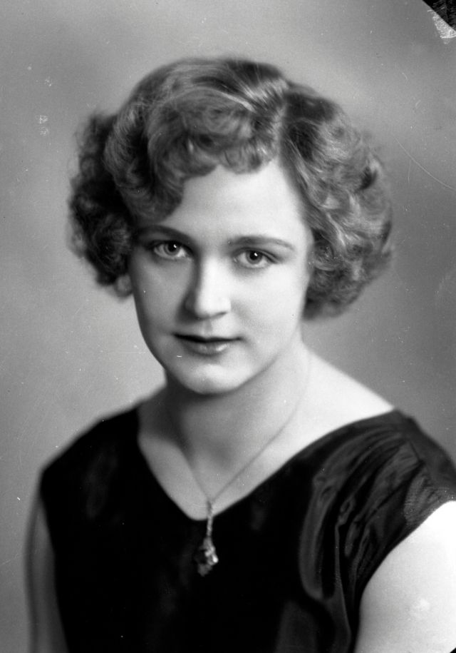
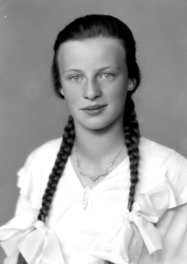
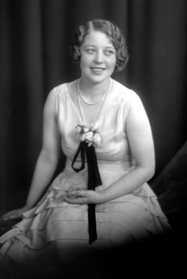
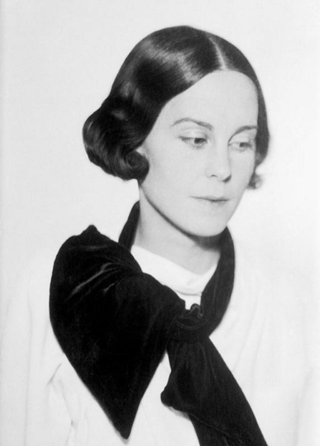
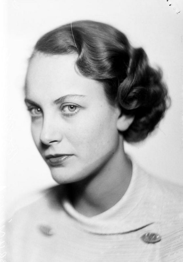
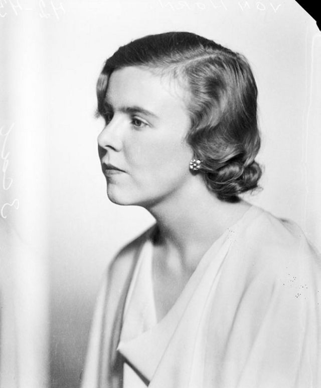
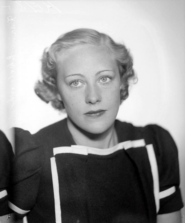
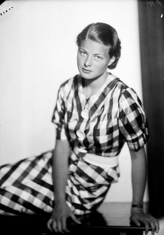
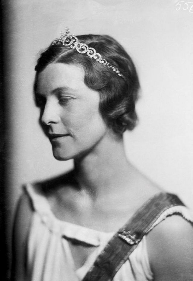
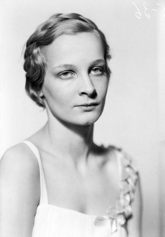
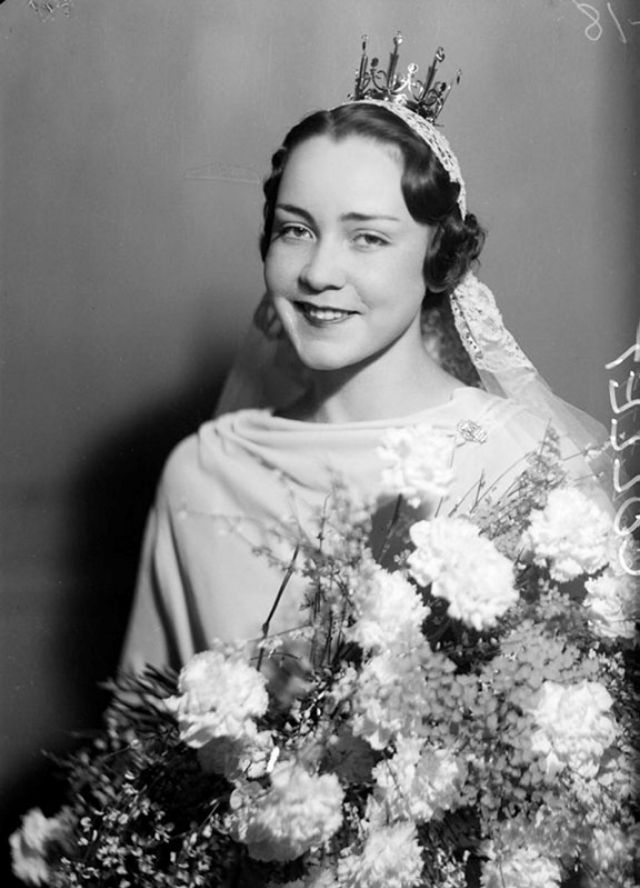
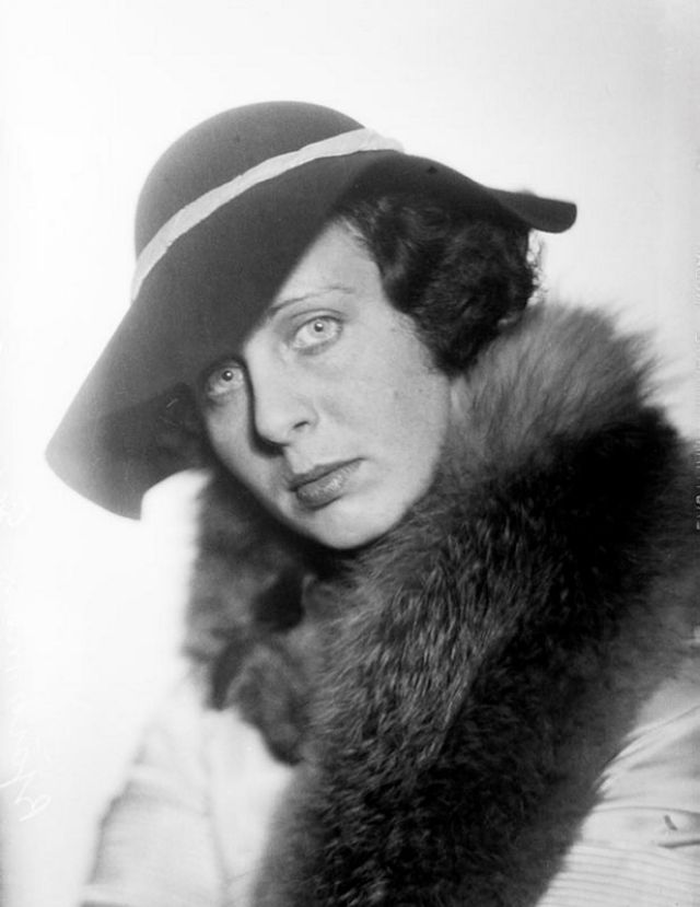
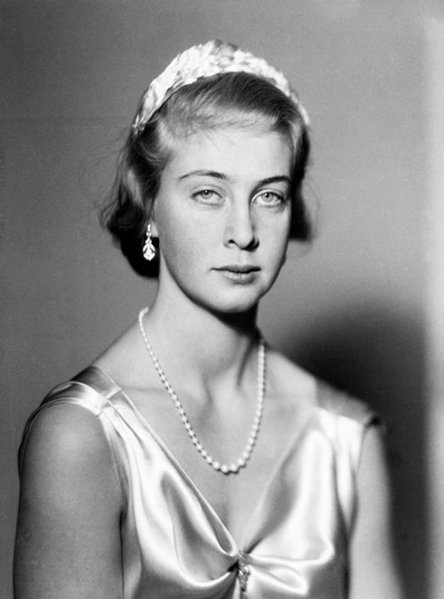
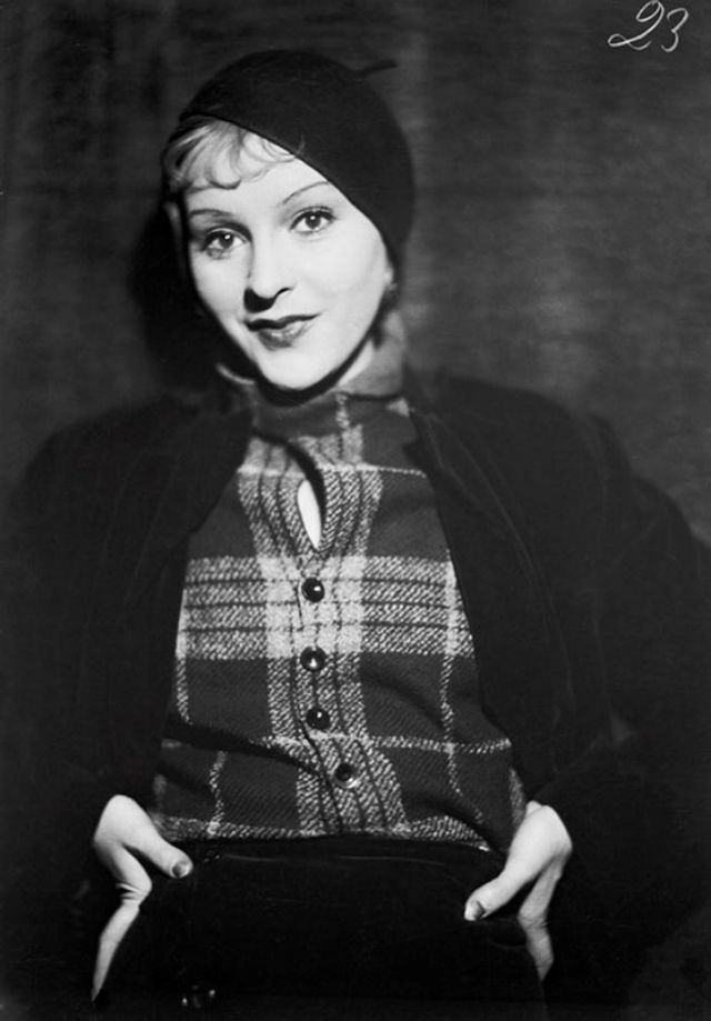
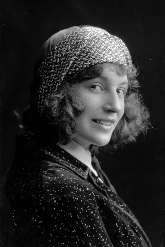
Women’s fashion in the 1930s was more conservative than that of the optimistic 1920s. Another contrast in fashion in the 1930s from that of the decade before was a return to a more feminine look for ladies.
Women’s curves were no longer being de-emphasized, skirts became longer, and clothes returned to being near the natural waistline.
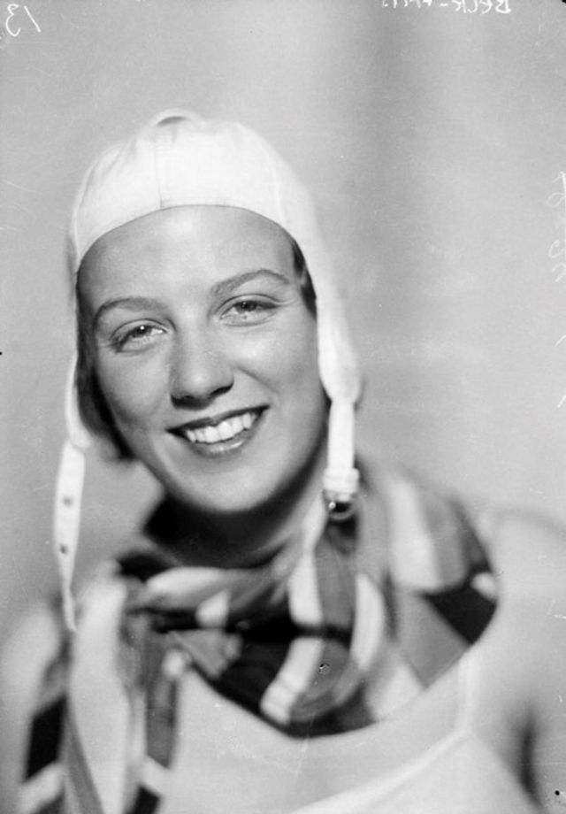
So what did Swedish women wear in the 1930s? Check out this gallery below of 50 stunning studio photos taken from 1930 to 1935.
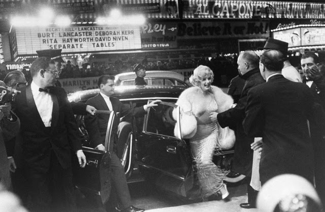
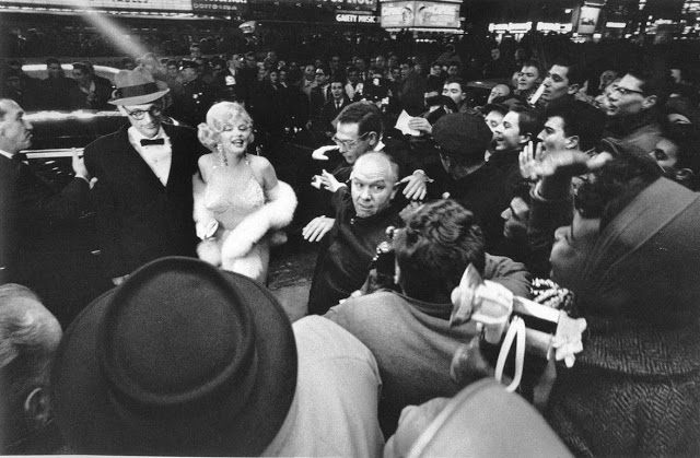
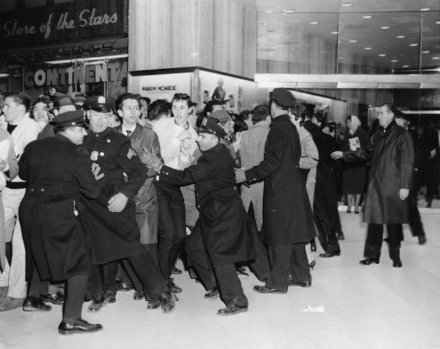
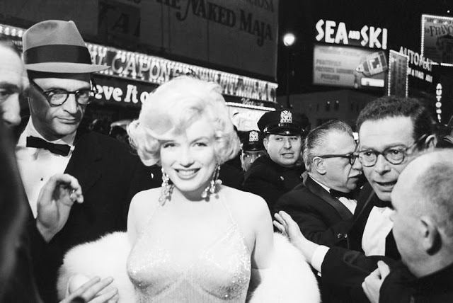
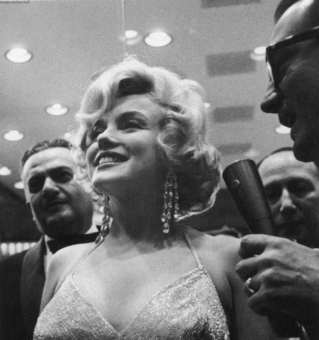
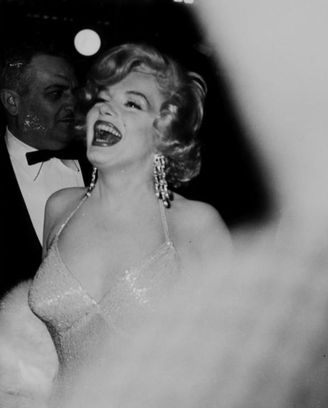
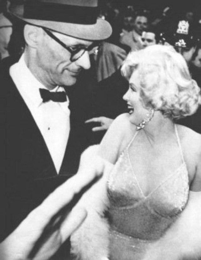
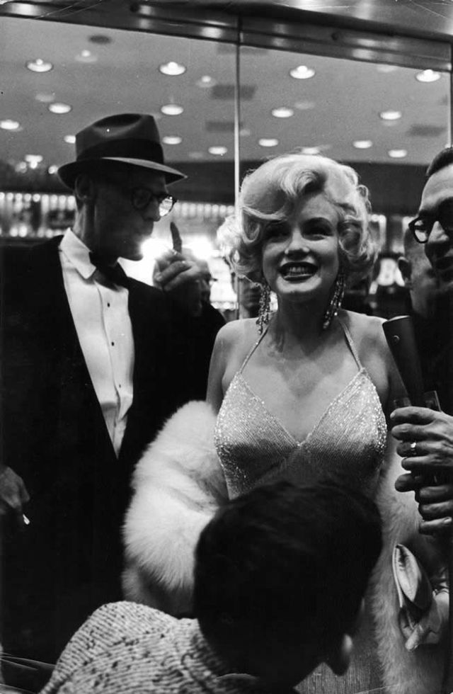
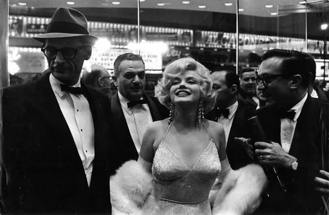
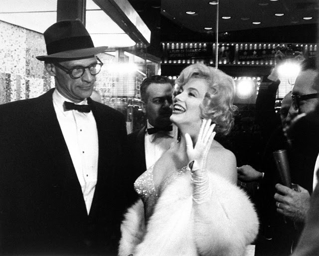
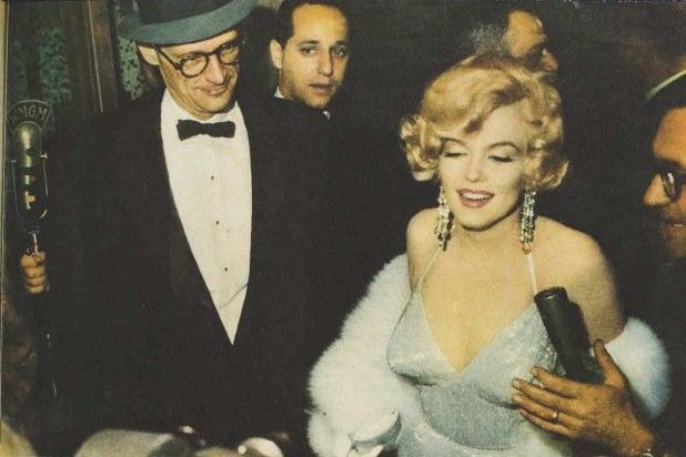
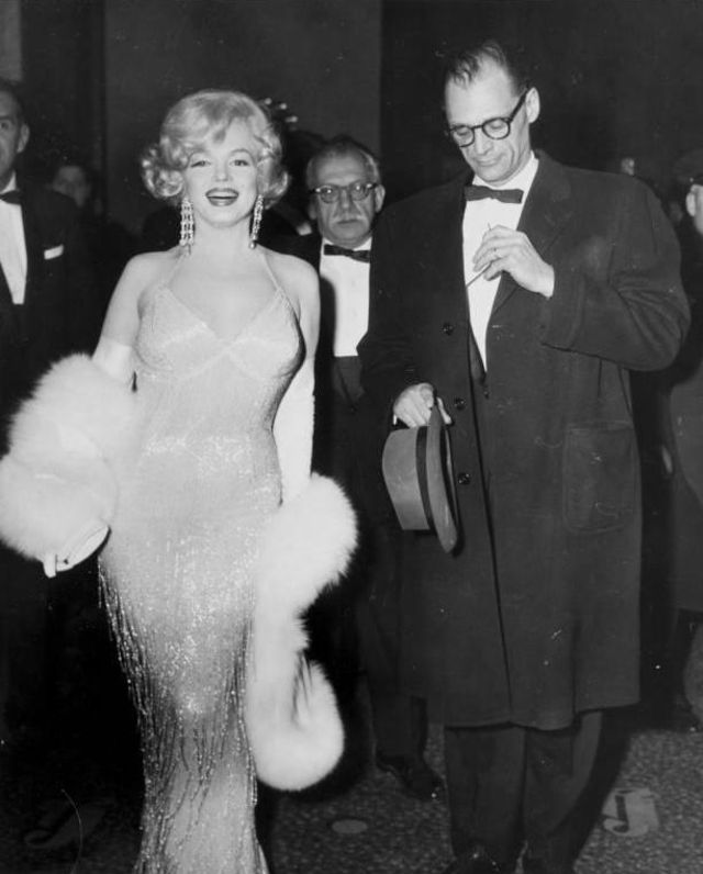
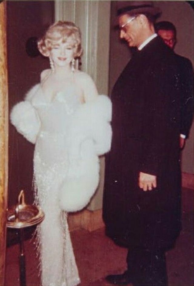
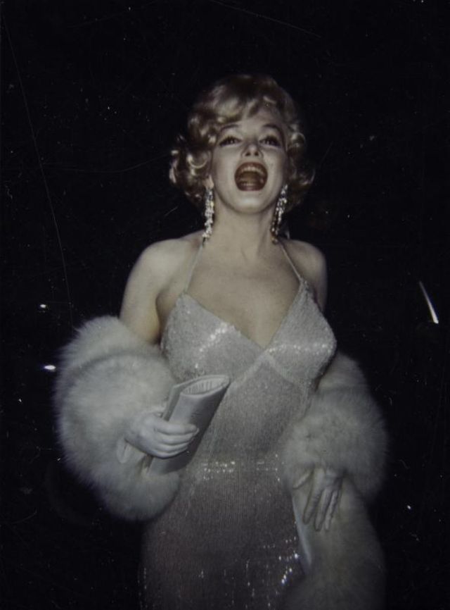
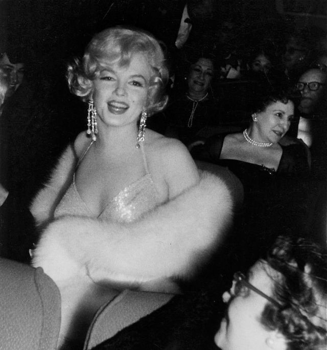
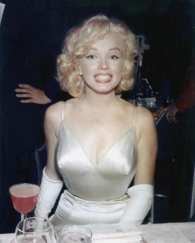
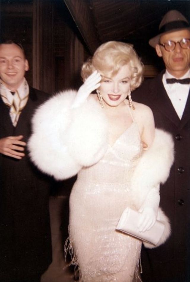
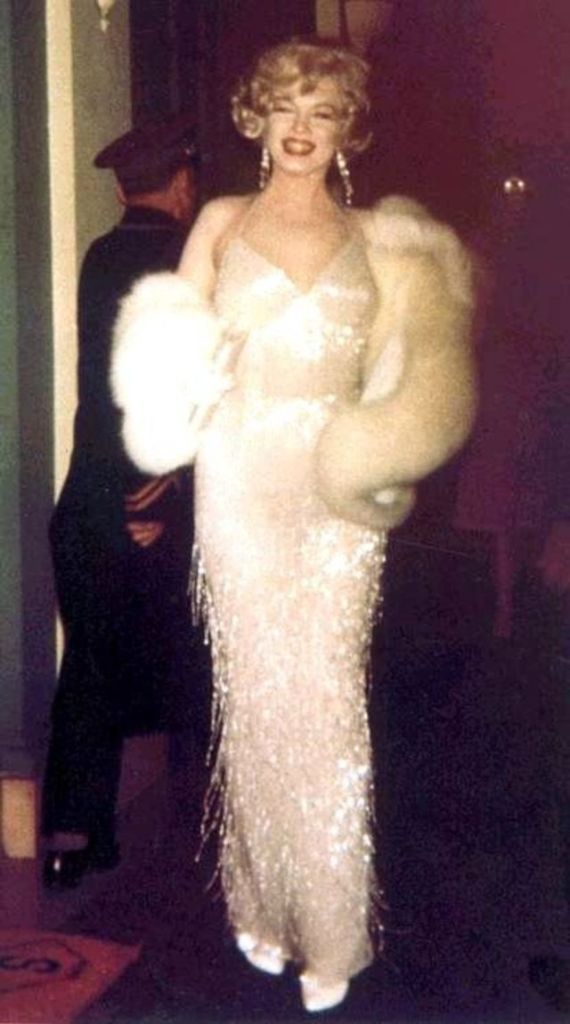
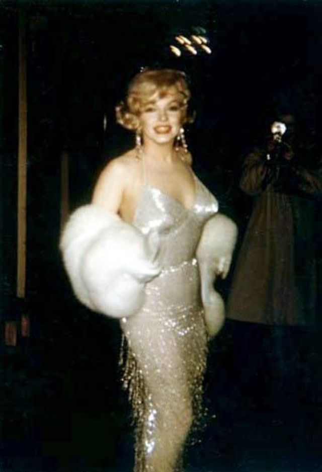
Some Like It Hot made its debut around the world in March 1959. Premiere’s were held in Chicago (which Marilyn attended) and Memphis on 17th March and then in Washington on the 21st March. But it was the New York premiere at the Lowe’s Capital Theatre on 29th March 1959 that fans remember most for the photographs and video footage of Marilyn arriving at the theatre arm in arm with her then husband Arthur Miller, greeting fans and photographers and still looking every inch the movie star in a gorgeous silver evening gown and fur wrap.
On the night of the premiere, 60 years ago today, Monroe, accompanied by Miller, told reporters Lemmon was the “funniest man in the world” and like the rest of the audience laughed all the way through the film. Critics also loved it and Some Like it Hot is now regarded as one of the all-time great film comedies. “The film did go considerably over budget. However, when it was all done and we looked at the film, I must say we were immensely enthused and we genuinely felt that this was a truly wonderful comedy. I don’t know that I would have believed then that it could have stood the test of all the time that has passed since it was first shown, but we sure thought it was good. I didn’t know it would last fifty or a hundred years.
It became the cornerstone of the long relationship that we developed with Billy because he remained with us the longest of all the directors that we booked to our company. The film was a huge success and of course was a great launching pad for our company because it was very early on in our history and so it’s highly significant in my life and my career. With all the incredible movies that Billy’s made, this is in the top three. I like to think that it’s maybe the best American comedy ever made.” Walter Mirisch (Producer).
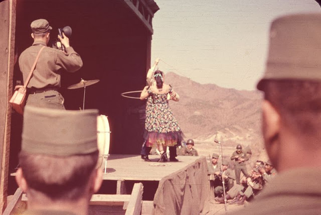
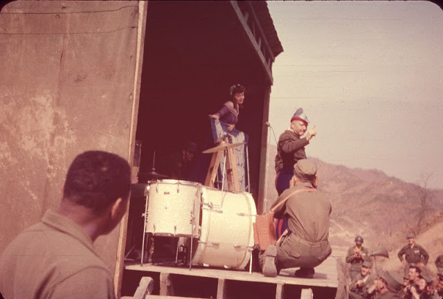
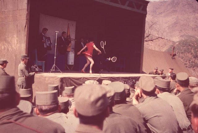
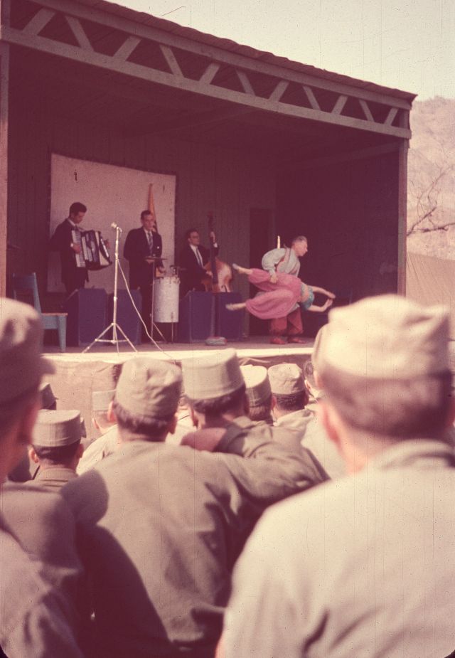
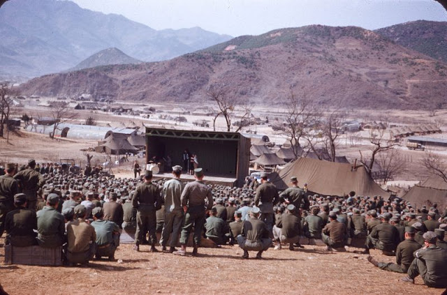
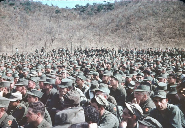
Founded in 1941 by Mary Ingraham in response to a request from President Franklin D. Roosevelt, The United Service Organizations Inc. (USO) is a nonprofit organization that provides live entertainment, such as comedians and musicians, and other programs to members of the United States Armed Forces and their families.
During World War II, the USO became the G.I.’s ‘home away from home’ and began a tradition of entertaining the troops that continues today. After disbanding in 1947, it was revived in 1950 for the Korean War, after which it also provided peacetime services. During the Vietnam War, USOs were sometimes located in combat zones.
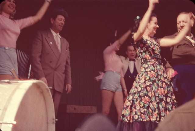
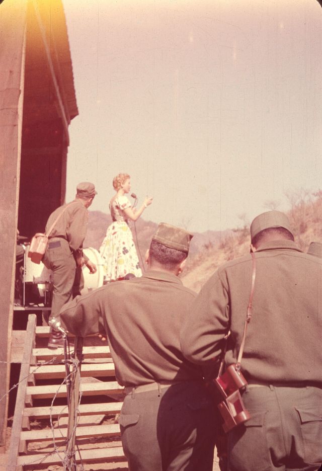
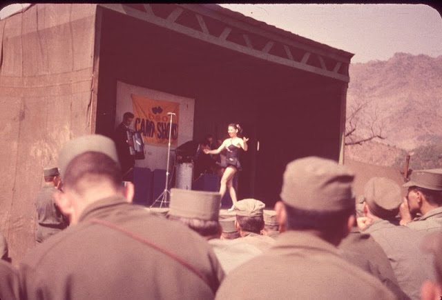
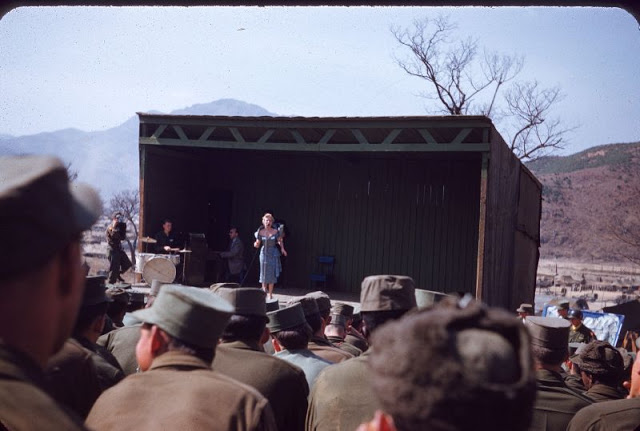
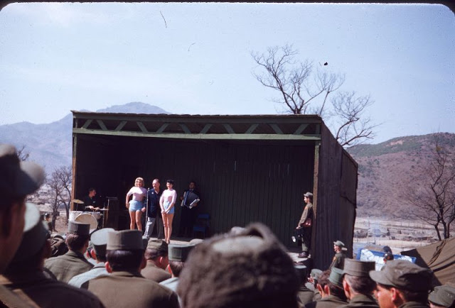
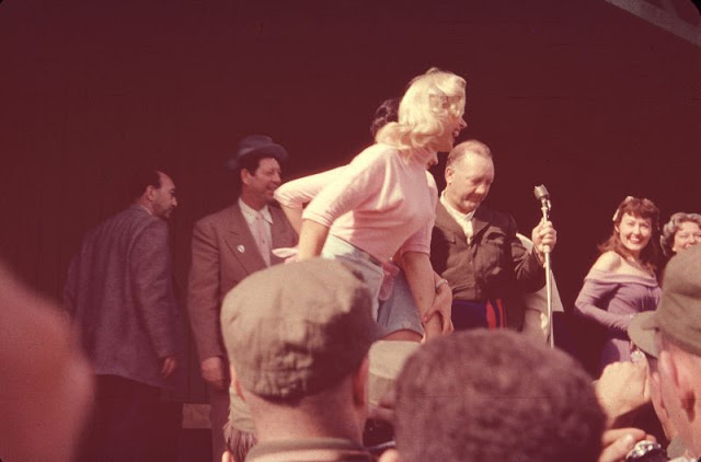
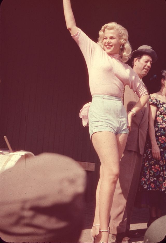
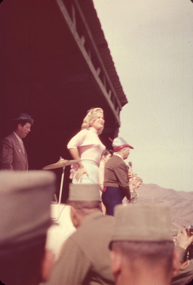
‘Slapsie Maxie’ was an ex-boxer named Max Rosenbloom, who was a nightclub owner, and comedian. His co-star was Gloria Pall, an aspiring actress who had a moment of notoriety later in 1954 when she starred as ‘Voluptua’ in a TV show.
These snapshots are a part of slides taken by U.S. Army photographer Edward Jay, 25th Replacement Co, 25th Inf. Division, US Army in 1954.
Gloria Pall, ‘Slapsie Maxie’ and other performers, Korea, April 1954Gloria Pall, ‘Slapsie Maxie’ and other performers, Korea, April 1954Gloria Pall and Max Rosenbloom, Korea, April 1954Performers at the ‘Slapsie Maxie’ show in Korea, April 1954Performers at the ‘Slapsie Maxie’ show in Korea, April 1954Performers at the ‘Slapsie Maxie’ show in Korea, April 1954Performers at the ‘Slapsie Maxie’ show in Korea, April 1954The ‘Slapsie Maxie’ show in Korea, April 1954The ‘Slapsie Maxie’ show in Korea, April 1954The ‘Slapsie Maxie’ show in Korea, April 1954The ‘Slapsie Maxie’ show in Korea, April 1954U.S. soldiers at ‘Slapsie Maxie’ show, Korea, April 1954U.S. soldiers at ‘Slapsie Maxie’ show, Korea, April 1954U.S. soldiers at ‘Slapsie Maxie’ show, Korea, April 1954At the ‘Slapsie Maxie’ show in Korea, April 1954At the ‘Slapsie Maxie’ show in Korea, April 1954Blonde bombshell Gloria Pall in Korea, April 1954Blonde bombshell Gloria Pall in Korea, April 1954Gloria Pall and Max Rosenbloom, Korea, April 1954Gloria Pall and ‘Slapsie Maxie’, Korea, April 1954Gloria Pall at ‘Slapsie Maxie’ show in Korea, April 1954
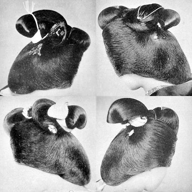
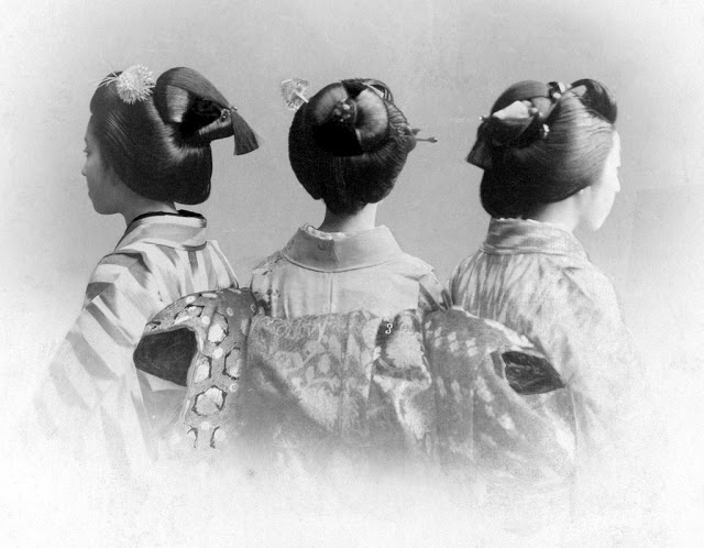
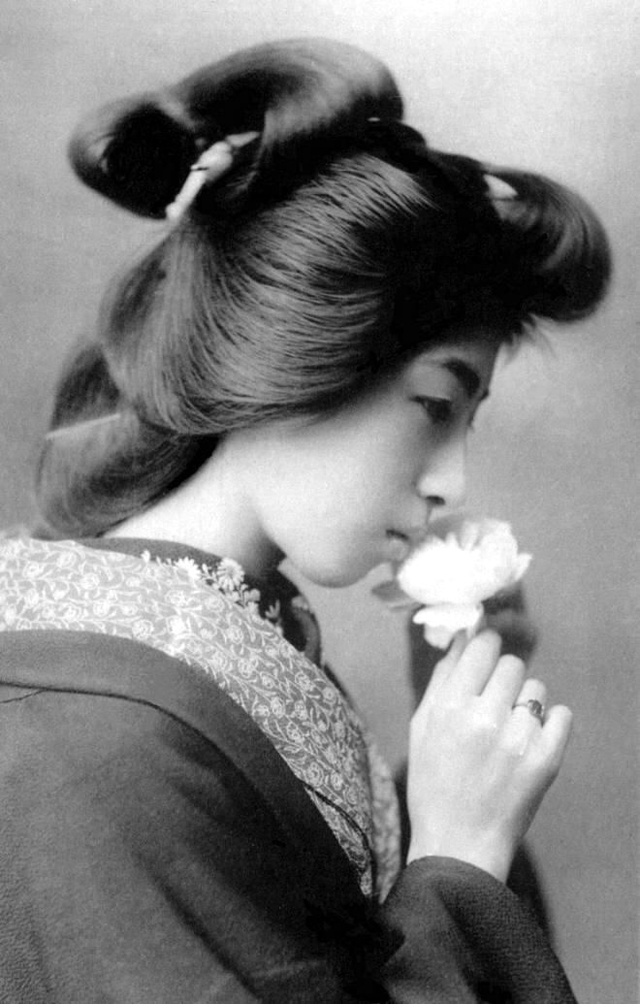
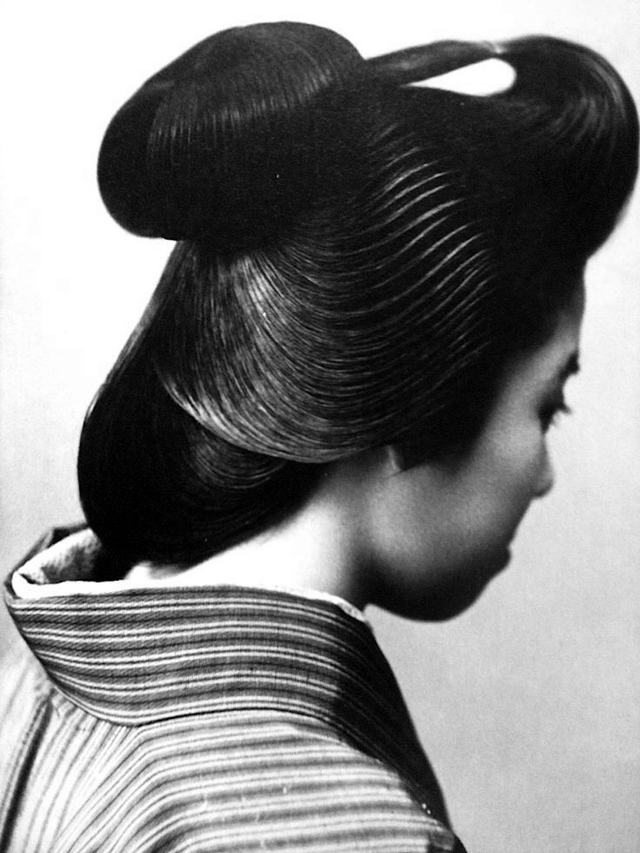
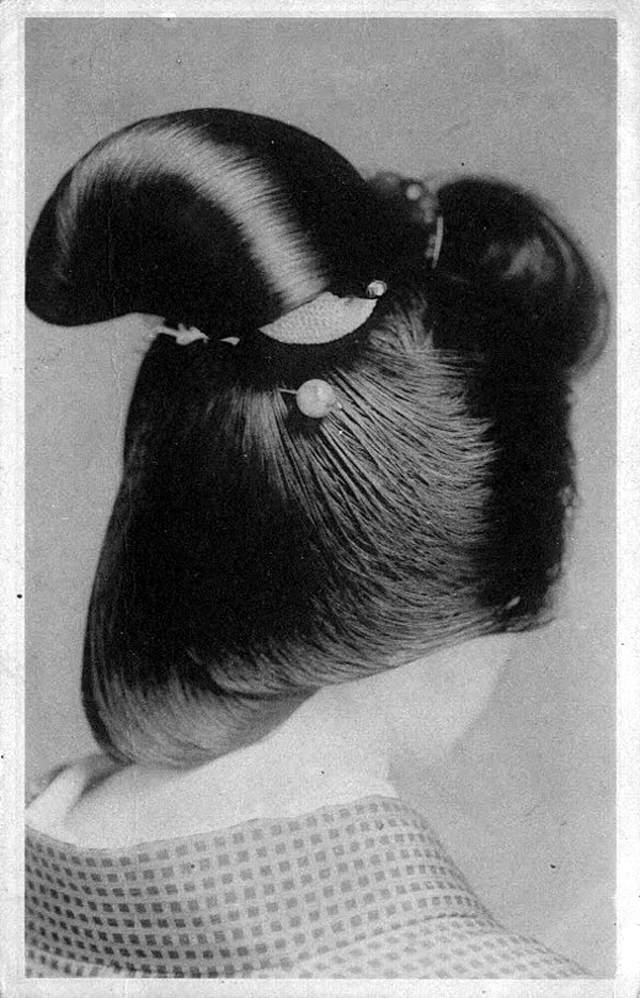
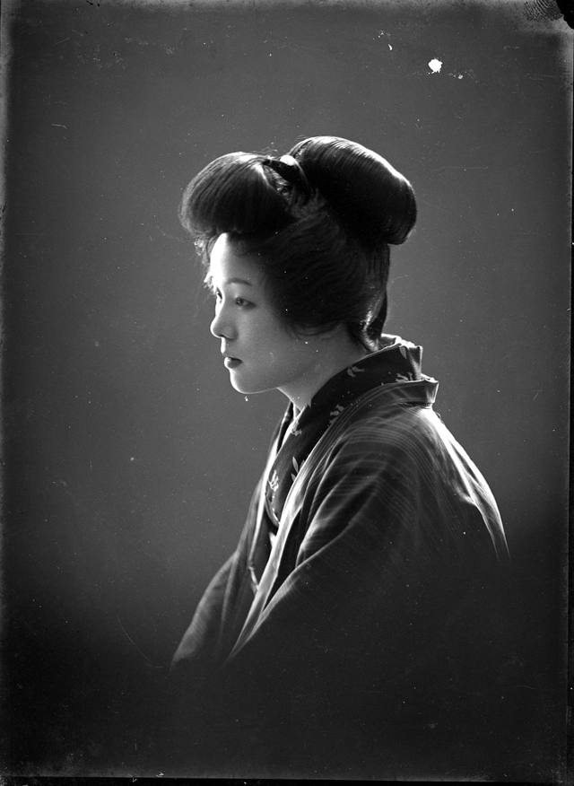
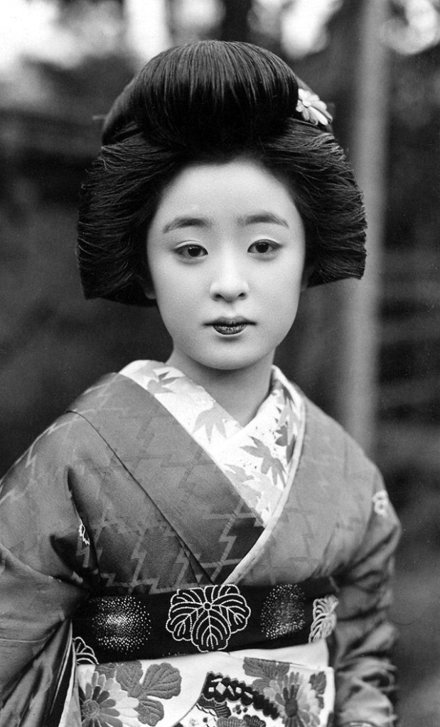
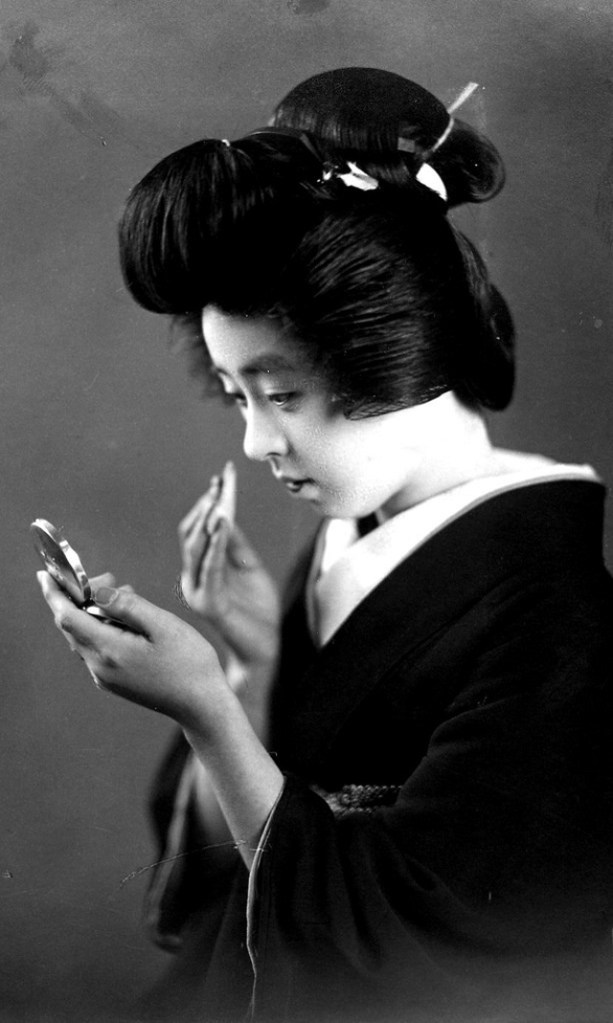
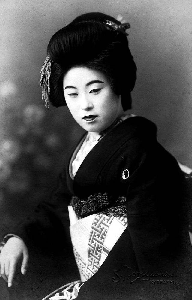
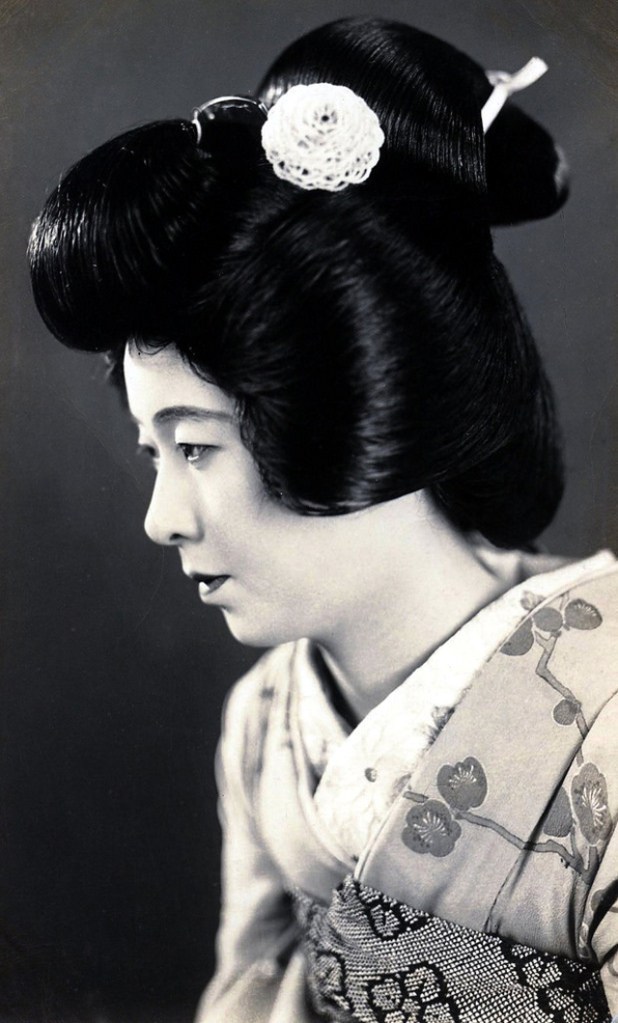
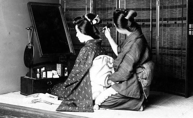
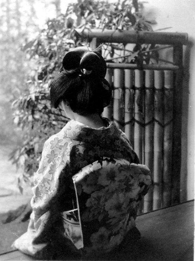
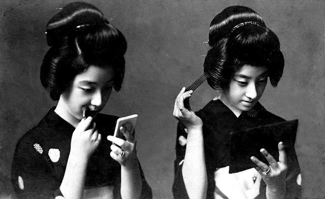
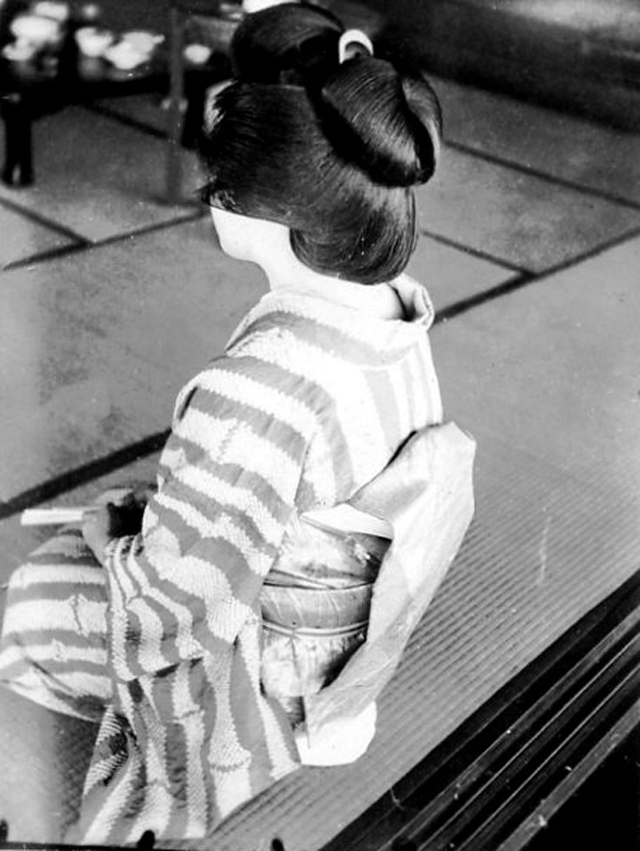
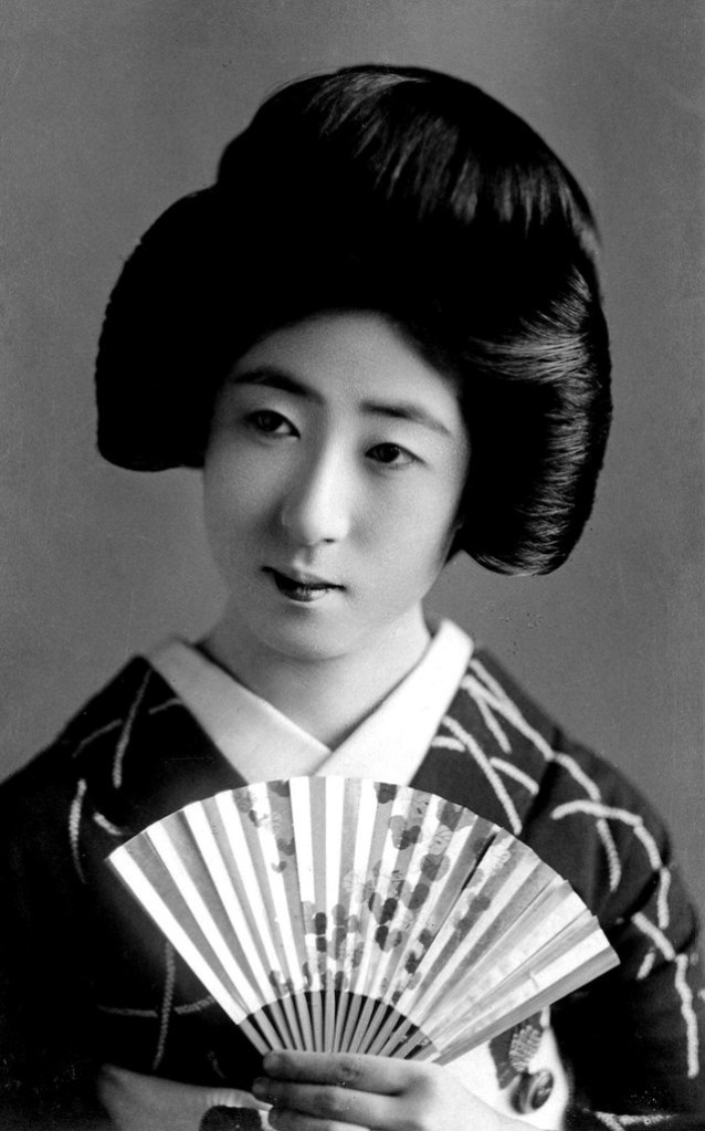
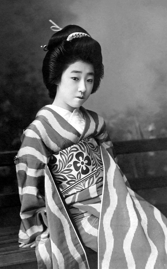
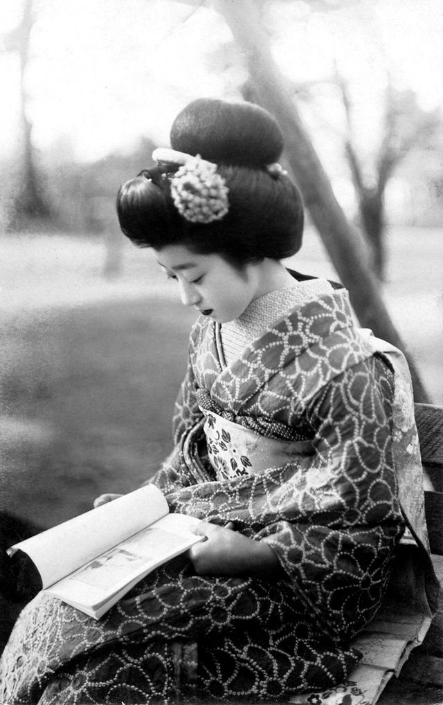
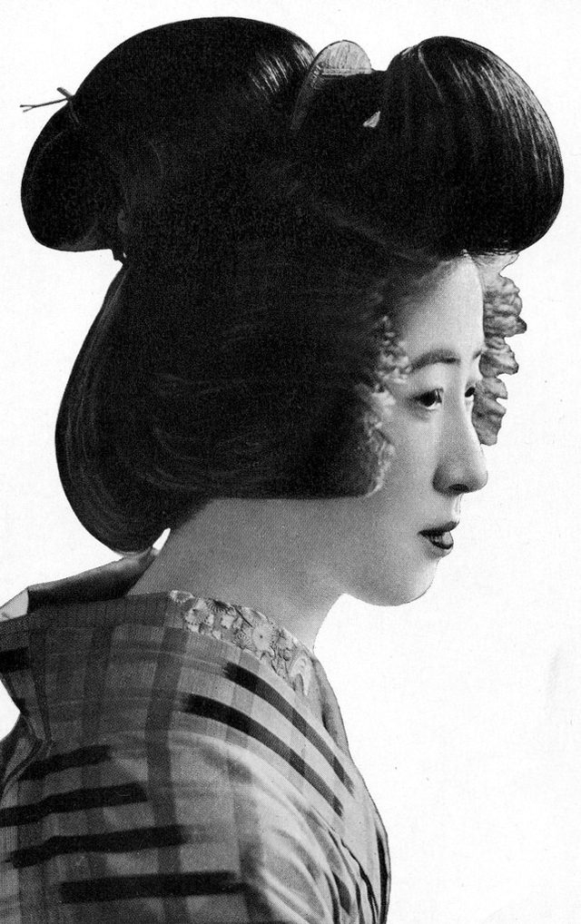
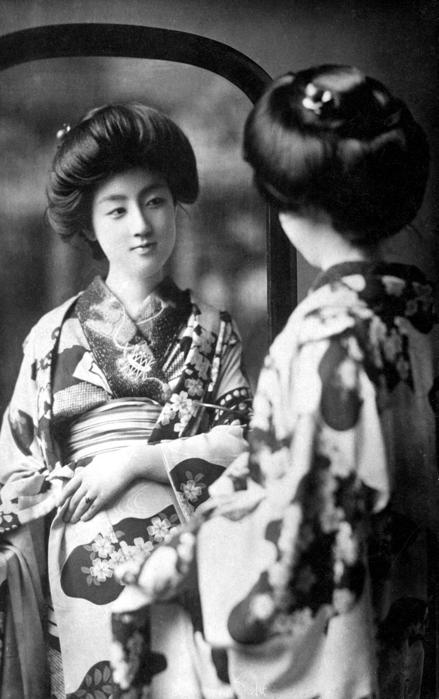
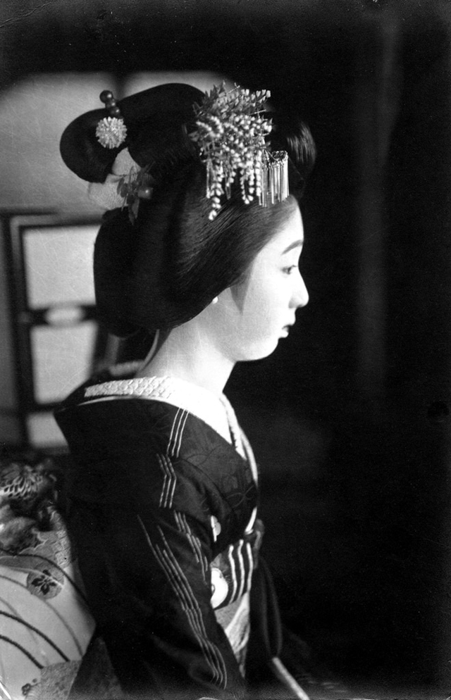
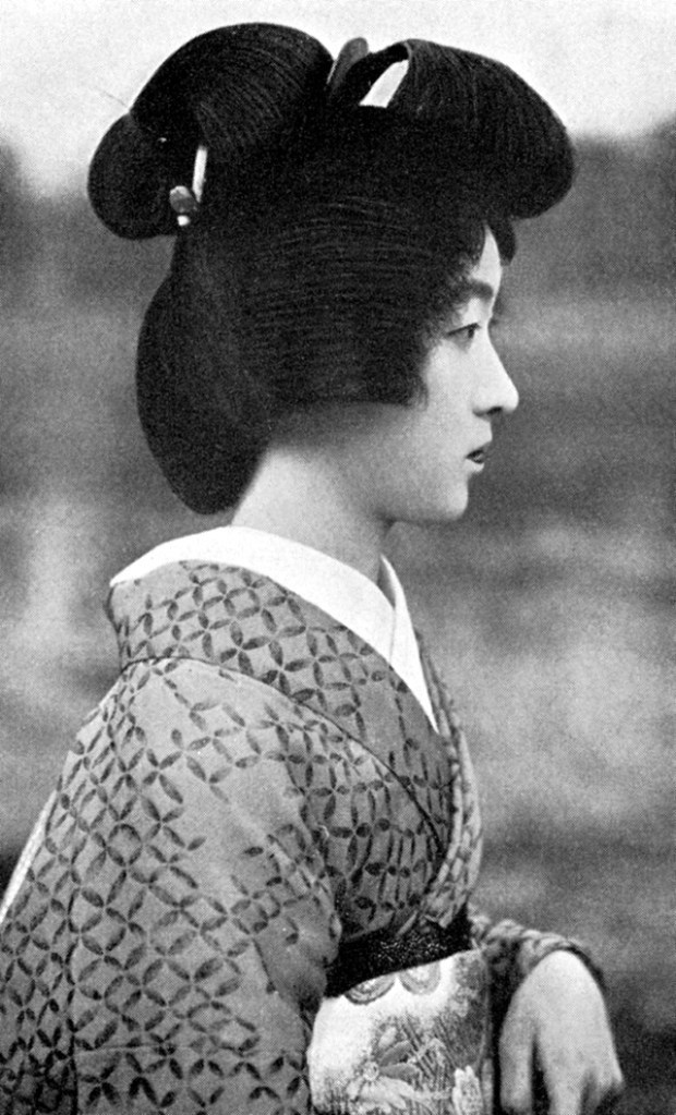
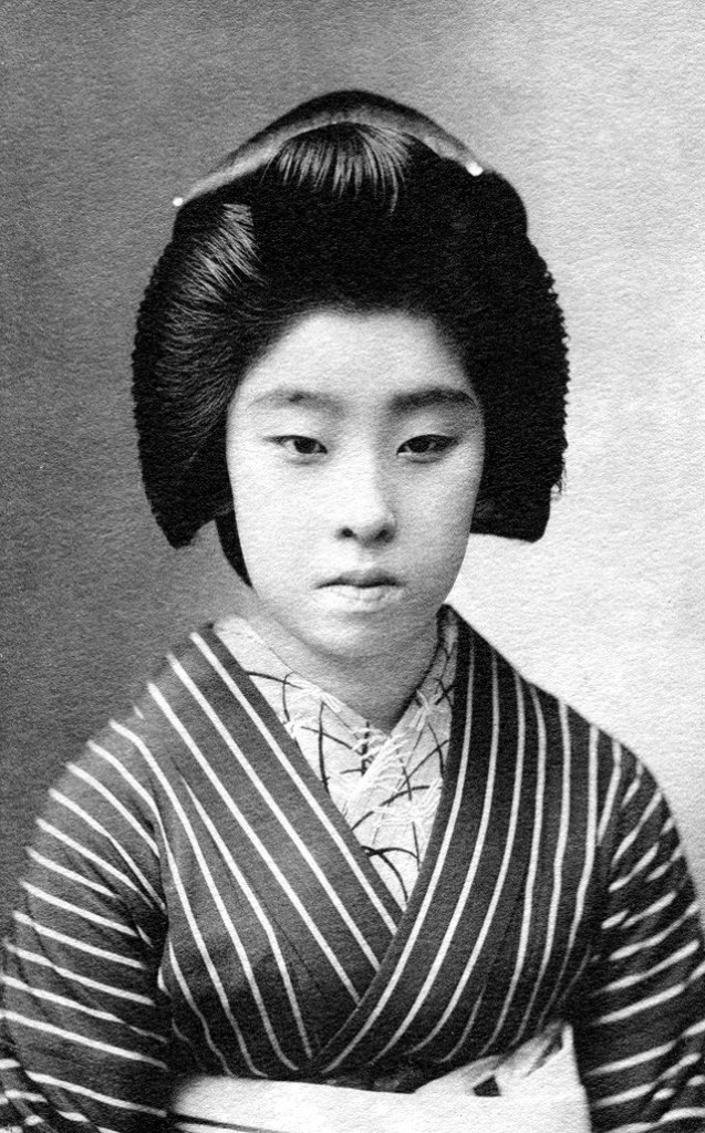
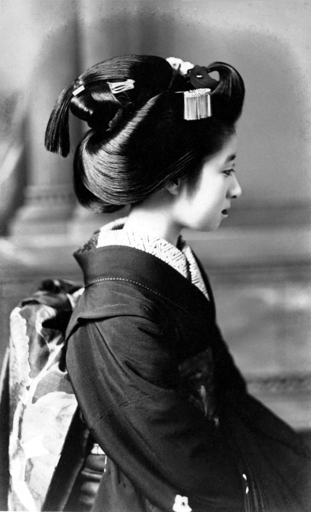
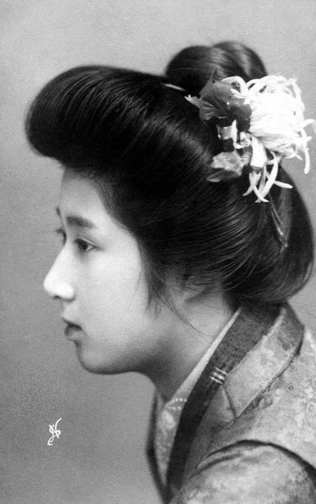
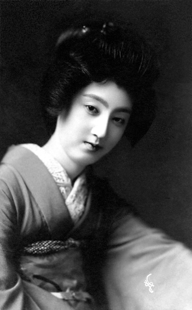
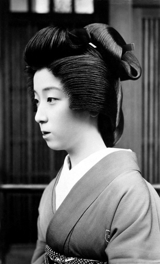
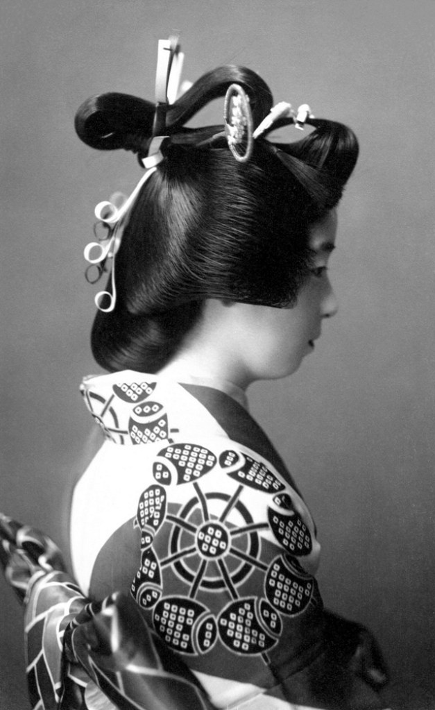
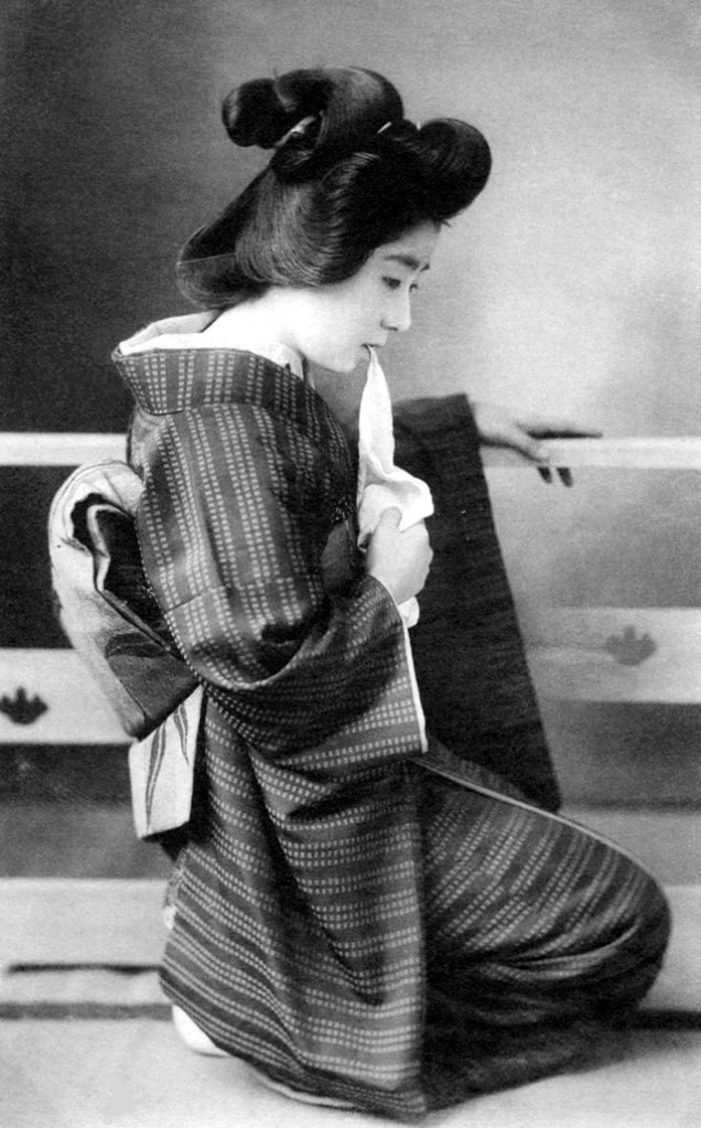
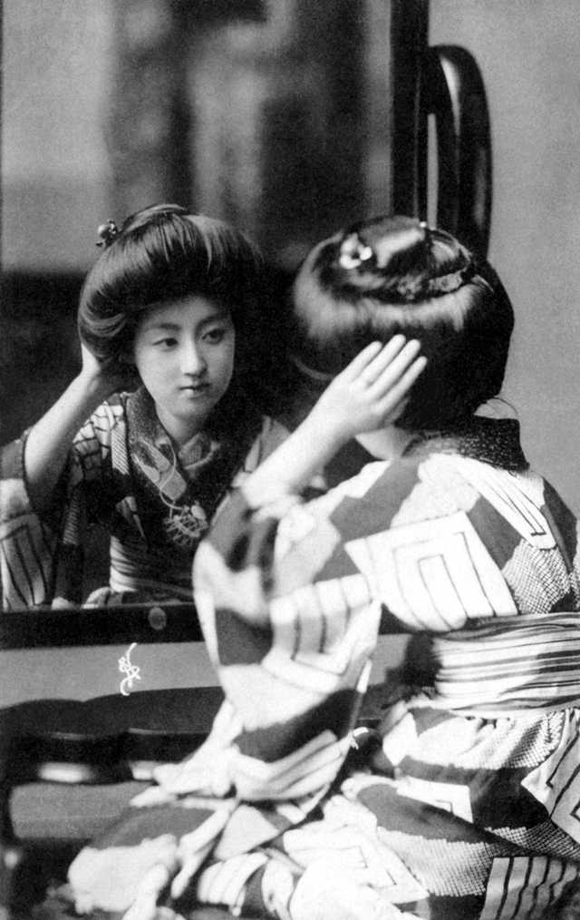
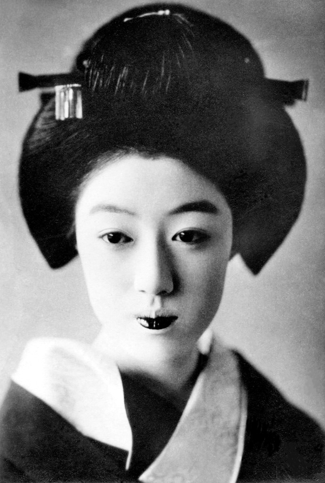
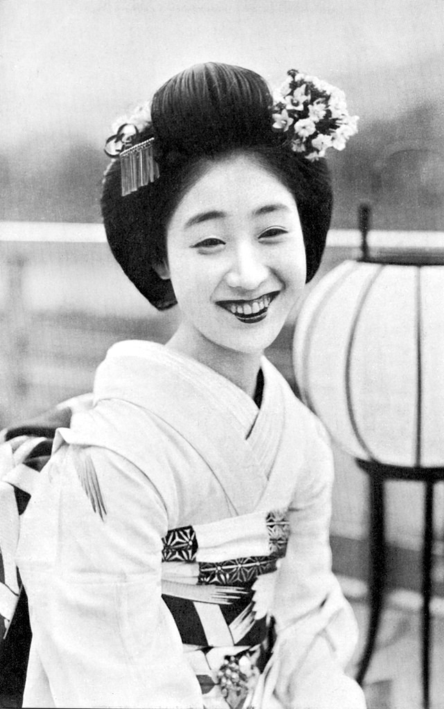
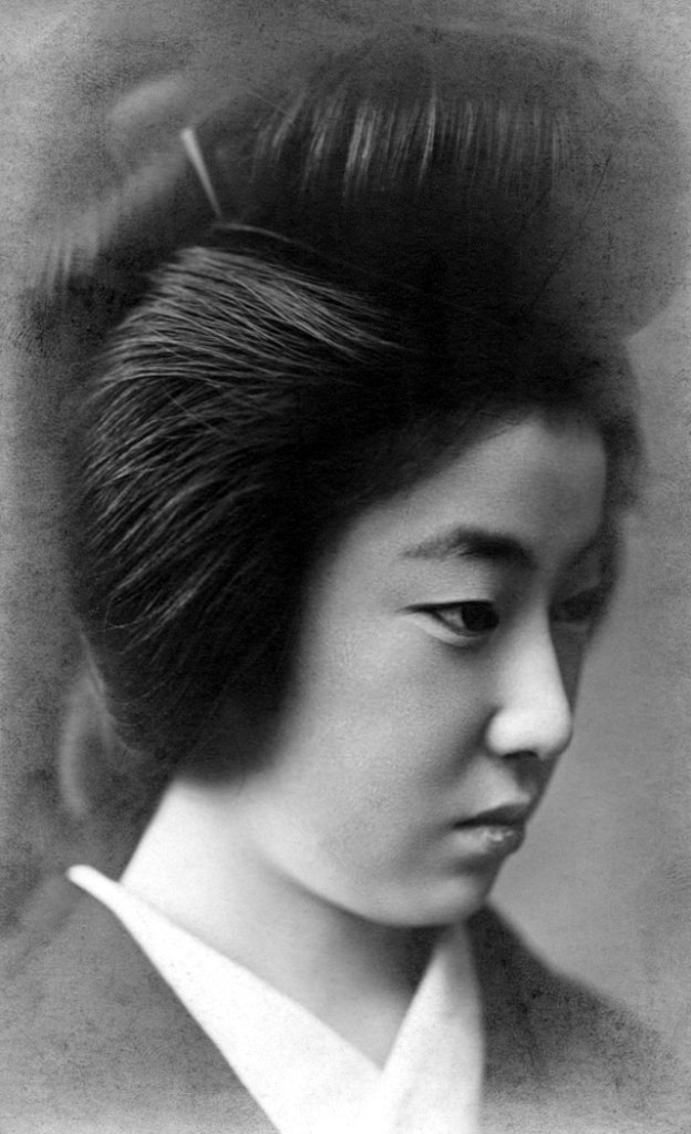
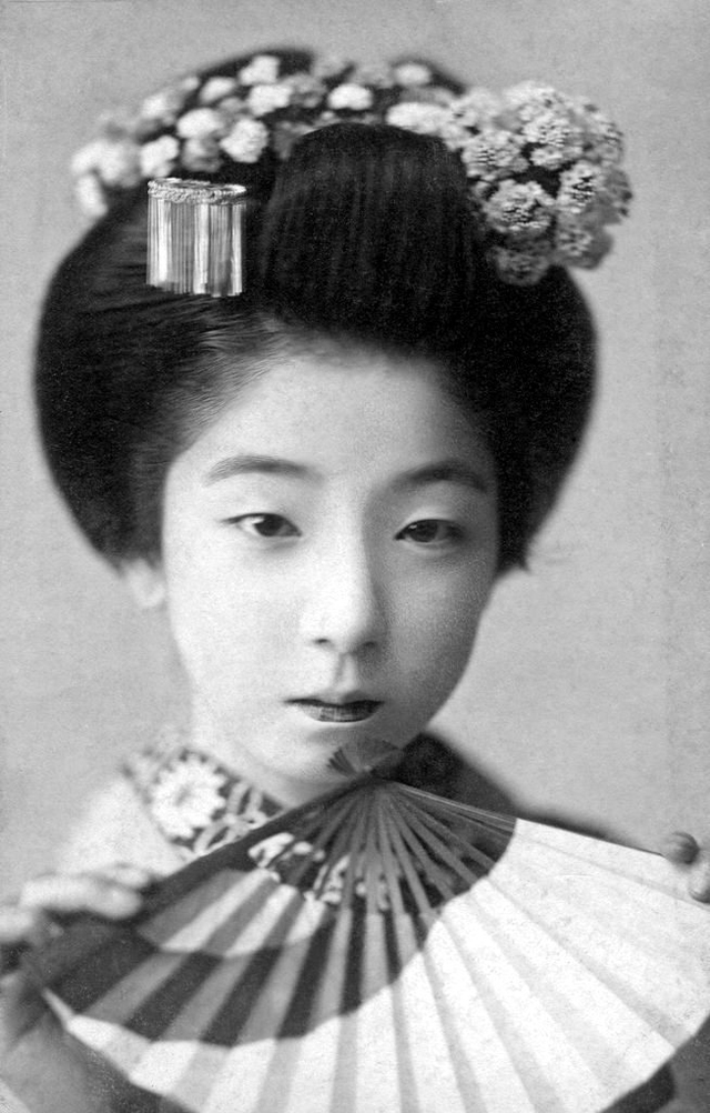
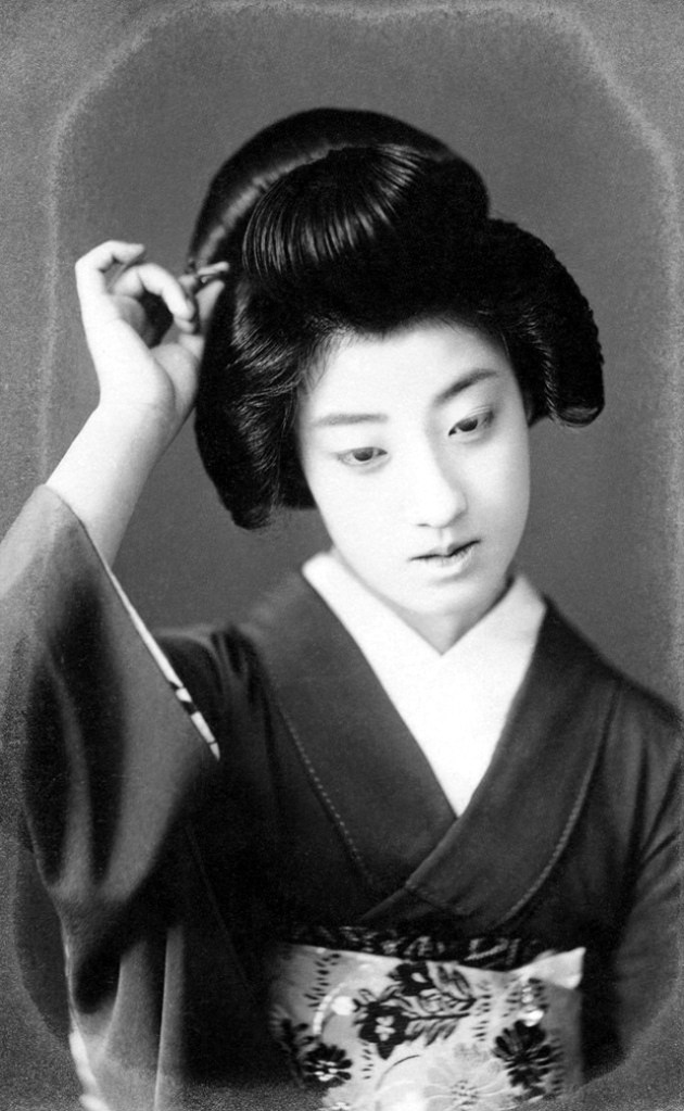
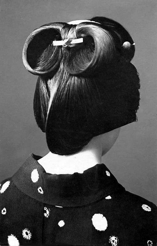
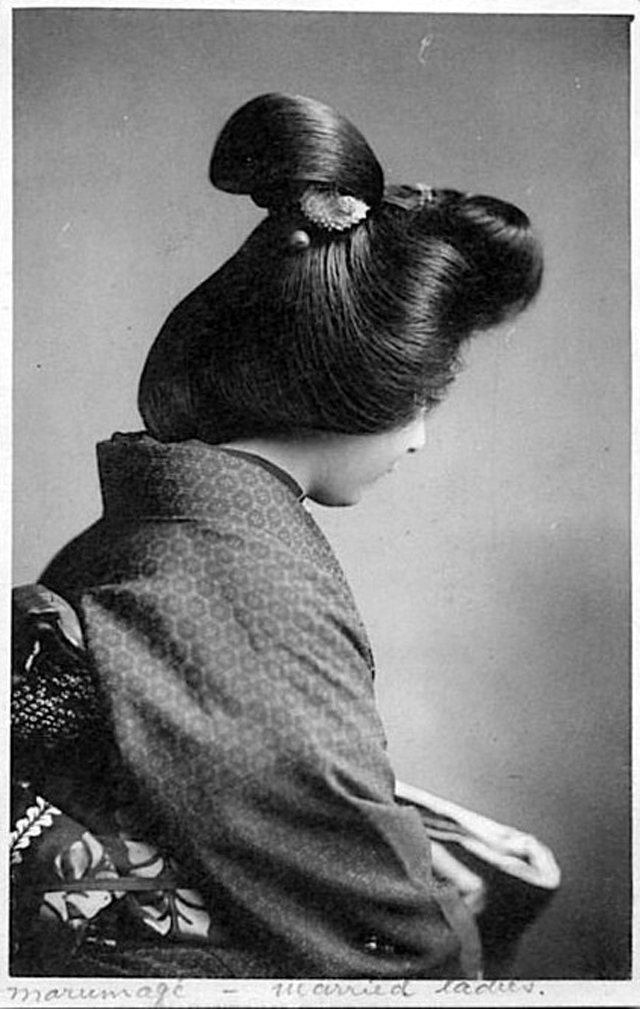
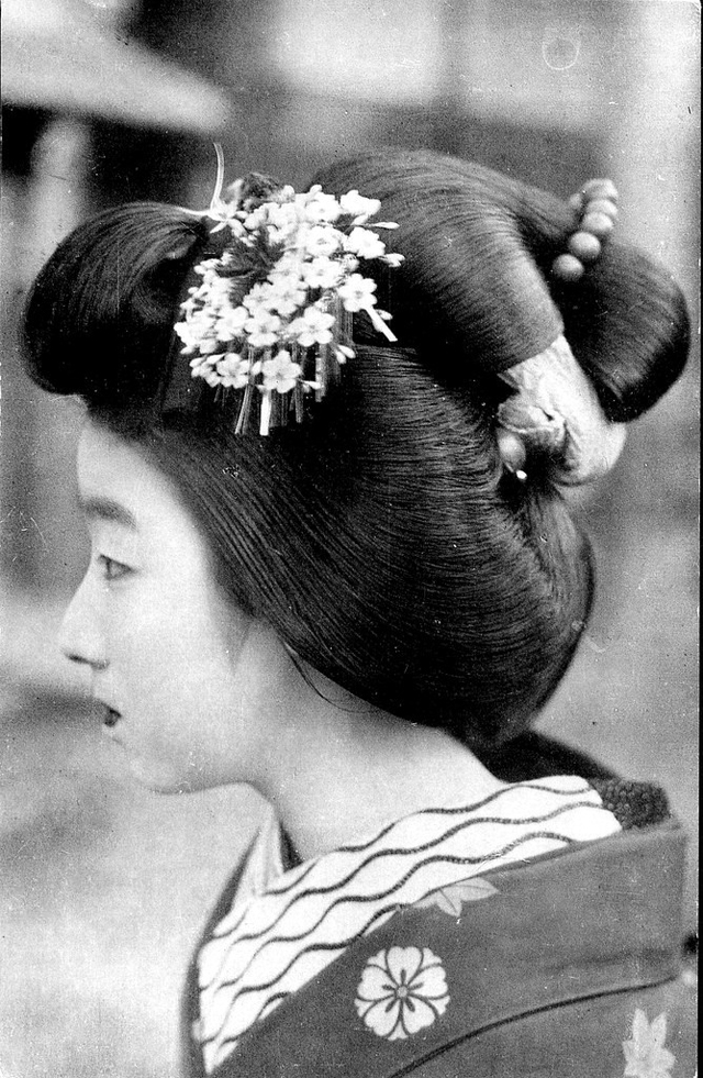
The Shimada is a women’s hairstyle in Japan, similar to a chignon. Generally the hair is gathered together at the crown of the head and a small portion of the bun is sectioned off to point outward.
This hairstyle was from the Edo period, and used still to this day. It became one of the traditional hairstyles of Japanese women.
Nihongami (日本髪, lit., “Japanese hair) is the term used for a number of traditional Japanese hairstyles considered to be distinctive in their construction and societal role.
Traditionally, the construction of most nihongami hairstyles consisted of two “wings” at the side of the head, curving upwards towards the back of the head to form a topknot or ponytail, with a long loop of hair below this also drawn into the topknot. Styles were accessorised with traditional hair accessories, though typically only by women; the combination of both style and accessories formed hairstyles that distinctively varied based on gender, age, job role and social standing.
Most styles of nihongami were hardened and shaped with wax, known as abura, and were styled with specially-carved combs made of either bamboo or boxwood, with heated tongs used to straighten the hair before styling. Hair styled in this manner was typically restyled weekly, and in some cases would necessitate sleeping on a pillow raised from the floor, known as a takamakura.
Nihongami are no longer commonly worn, and today are most often seen on maiko, geisha and sumo wrestlers. A number of different styles of nihongami are also worn by courtesan re-enactors, and many styles once common in the Edo period are seen faithfully reproduced in kabuki plays, which themselves also commonly date to the Edo period. Though some styles of nihongami are well documented, others have, over time, fallen into obscurity, with little in the way of documentation in regards to their appearance, name, origin and method of styling.
Here is a photo collection of Japanese women with their lovely Shimada hairstyle in the early 20th century.
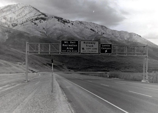
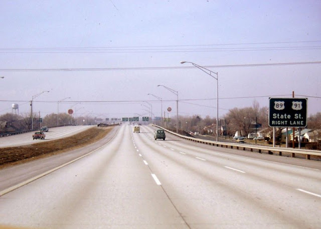
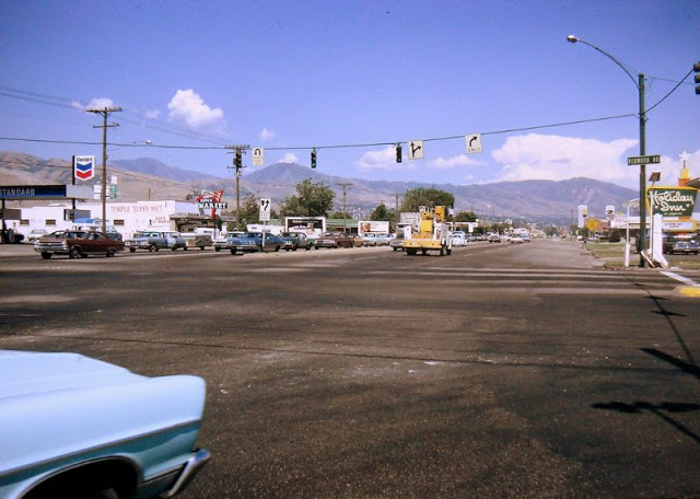
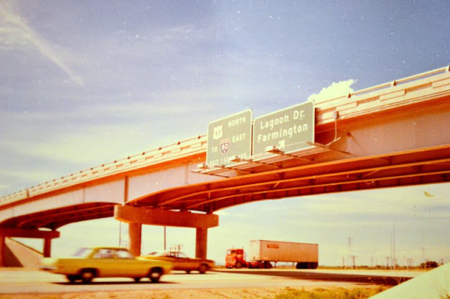
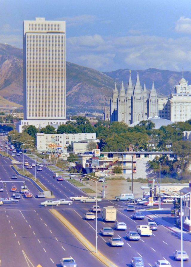
Salt Lake City (often shortened to Salt Lake and abbreviated as SLC) is the capital and most populous city of the U.S. state of Utah, as well as the seat of Salt Lake County, the most populous county in Utah. With a population of 199,723 in 2020, the city is the core of the Salt Lake City metropolitan area, which has a population of 1,257,936 (as of the 2020 census). Salt Lake City is further situated within a larger metropolis known as the Salt Lake City–Ogden–Provo Combined Statistical Area, a corridor of contiguous urban and suburban development stretched along a 120-mile (190 km) segment of the Wasatch Front, comprising a population of 2,606,548 (as of 2018 estimates), making it the 22nd largest in the nation. It is also the central core of the larger of only two major urban areas located within the Great Basin (the other being Reno, Nevada).
Salt Lake City was founded in 1847 by early pioneer settlers, led by Brigham Young, who were seeking to escape persecution they had experienced while living farther east. The Mormon pioneers, as they would come to be known, entered a semi-arid valley and immediately began planning and building an extensive irrigation network which could feed the population and foster future growth. Salt Lake City’s street grid system is based on a standard compass grid plan, with the southeast corner of Temple Square (the area containing the Salt Lake Temple in downtown Salt Lake City) serving as the origin of the Salt Lake meridian. Owing to its proximity to the Great Salt Lake, the city was originally named Great Salt Lake City. In 1868, the word “Great” was dropped from the city’s name.
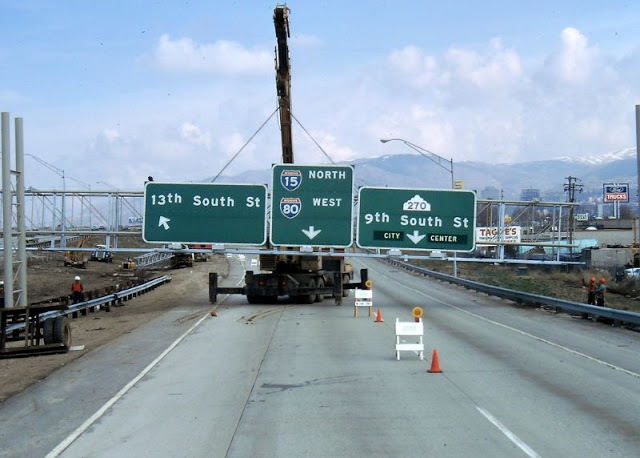
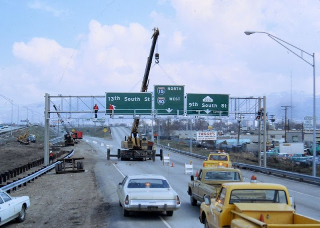
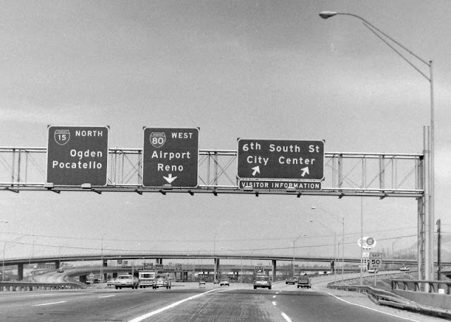
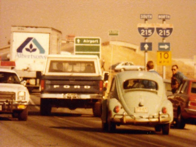
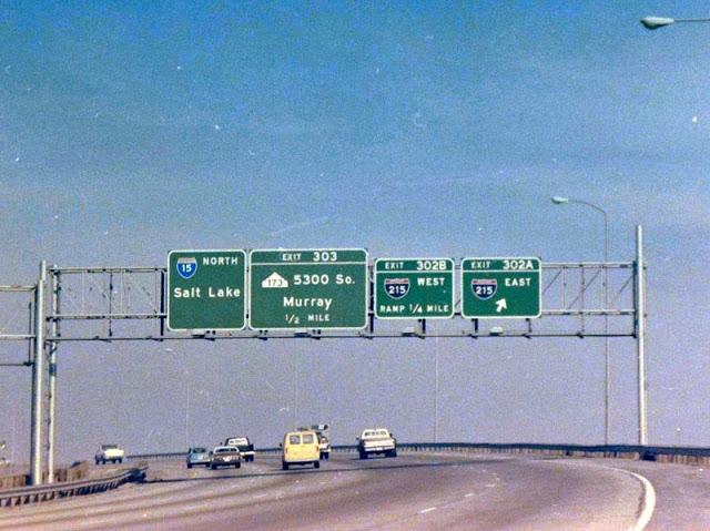
Immigration of international members of The Church of Jesus Christ of Latter-day Saints, mining booms, and the construction of the first transcontinental railroad initially brought economic growth, and the city was nicknamed “The Crossroads of the West”. It was traversed by the Lincoln Highway, the first transcontinental highway, in 1913. Two major cross-country freeways, I-15 and I-80, now intersect in the city. The city also has a belt route, I-215.
Salt Lake City has developed a strong tourist industry based primarily on skiing and outdoor recreation. It hosted the 2002 Winter Olympics. It is known for its politically liberal and diverse culture, which stands at contrast with the rest of the state’s conservative leanings. It is home to a significant LGBT community and hosts the annual Utah Pride Festival. It is the industrial banking center of the United States.[14] Salt Lake City and the surrounding area are also the location of several institutions of higher education including the state’s flagship research school, the University of Utah. Sustained drought in Utah has more recently strained Salt Lake City’s water security and caused the Great Salt Lake level drop to record low levels. (Wikipedia)
Queens is a borough of New York City, coextensive with Queens County, in the U.S. state of New York. Located on Long Island, it is the largest borough of New York City in area; it is bordered by the borough of Brooklyn at the western tip of Long Island to its west and Nassau County to the east. Queens also shares water borders with the boroughs of Manhattan, the Bronx, and Staten Island (via the Rockaways).
With a population of 2,405,464 as of the 2020 census, Queens is the second most populous county in New York State, second to Kings County (Brooklyn), and is therefore also the second most populous of the five New York City boroughs. Were it a city, Queens would rank as the fourth most-populous in the U.S. Approximately 47 percent of the residents of Queens are foreign-born. Queens is the most linguistically diverse place on Earth and is one of the most ethnically diverse counties in the United States.
Queens was established in 1683 as one of the original 12 counties of the Province of New York. The settlement was presumably named for the English Queen Catherine of Braganza (1638–1705). From 1683 to 1899, the County of Queens included what is now Nassau County. Queens became a borough during the consolidation of New York City in 1898, combining the separate towns of Long Island City, Newtown, Flushing, Jamaica, and western Hempstead. With the exception of Hempstead, all are today considered neighborhoods of Queens.
Queens has the most diversified economy of the five boroughs of New York City. It is home to two of New York City’s airports: John F. Kennedy and LaGuardia. Landmarks in Queens which support its economy include Flushing Meadows–Corona Park; Citi Field, home to the New York Mets baseball team; the USTA Billie Jean King National Tennis Center, site of the U.S. Open tennis tournament; Kaufman Astoria Studios; Silvercup Studios; and the Aqueduct Racetrack. Flushing is undergoing rapid gentrification with investment by Chinese transnational entities, while Long Island City is undergoing gentrification secondary to its proximity across the East River from Manhattan.
The borough has diverse housing, ranging from high-rise apartment buildings in some areas of western and central Queens, such as Ozone Park, Jackson Heights, Flushing, Astoria, and Long Island City, to neighborhoods with many low-rise structures in the eastern part of the borough. (Wikipedia)
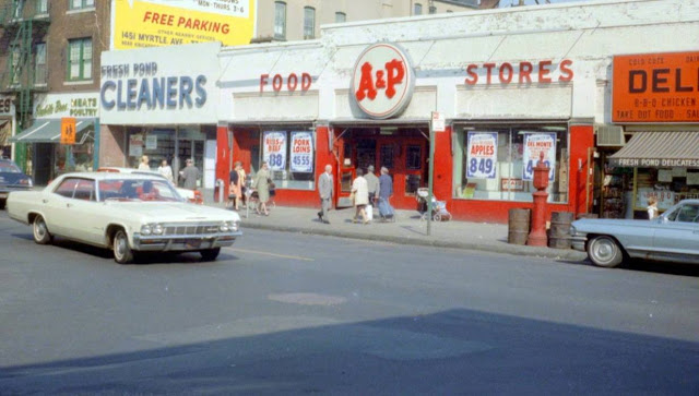
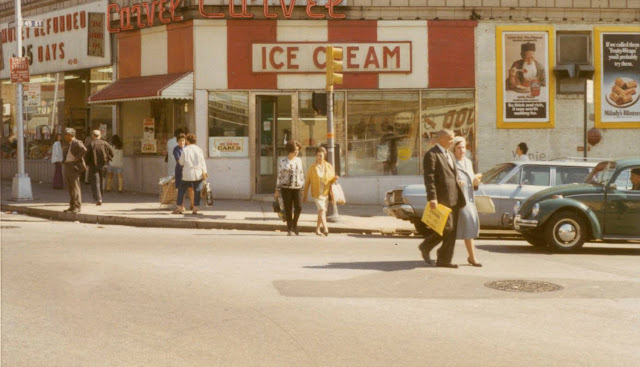
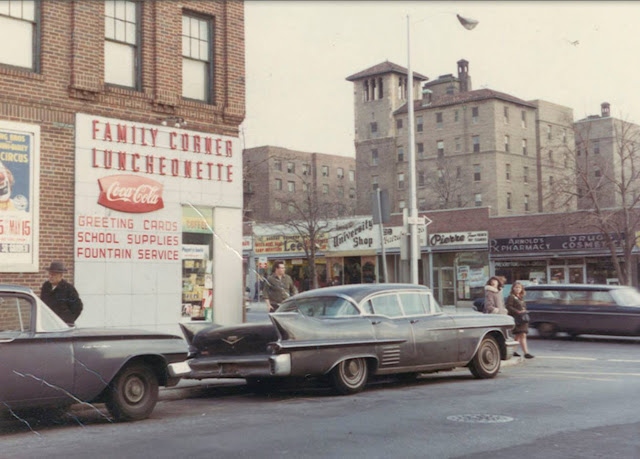
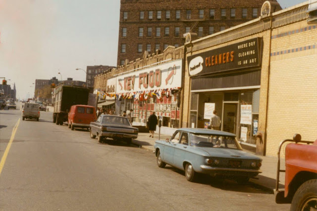
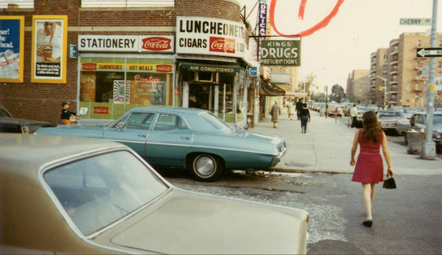
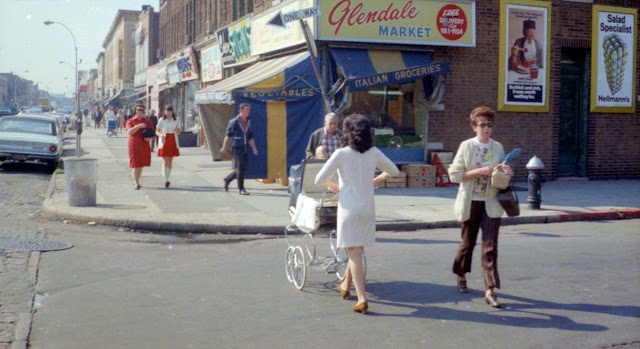
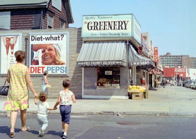
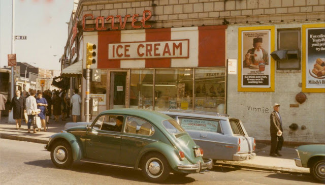
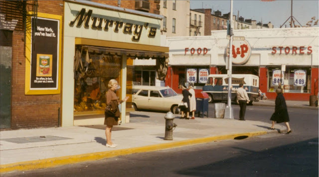
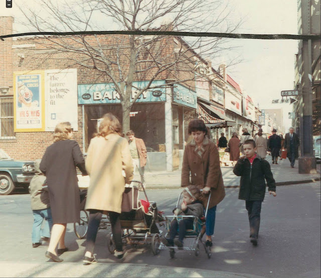
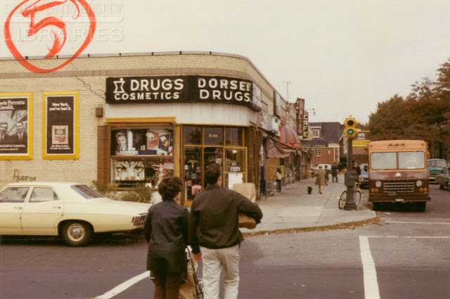
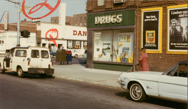
Queens/ Ridgewood: Fresh Pond Road and Putnam Avenue, ca. 1960s.Queens/ Ridgewood: Cypress Avenue and Putnam Avenue, October 1969.Queens/ Sunnyside: Greenpoint Avenue and 45th Street, 1969.Queens/ Jackson Heights: 80th Street and Northern Boulevard, ca. 1960s.Queens/ Sunnyside: Greenpoint Avenue off 45th Street, 1969.Queens/ Astoria: 34th Street and 30th Avenue, ca. 1960s.Queens/ Flushing: Cherry Avenue and Kissena Boulevard, September 1969.Queens/ Astoria: 30th Avenue and 42nd Street, 1968.Queens/ Astoria: Another view of 30th Avenue and 42nd Street in Astoria, 1968.Queens/ Glendale: Myrtle Avenue and 68th Street, ca. 1960s.Queens/ Rego Park: 63rd Drive and Booth Street, ca. 1960s.Queens/ Maspeth: Flushing Avenue off 61st Street; Trolleybus, 1960.Queens/ Astoria: 34th Street and 30th Avenue, ca. 1960s.Queens/ Rego Park: 63rd Drive and Wetherole Street, 1969.Queens/ Sunnyside: Another view of Greenpoint Avenue and 45th Street, 1969.Queens/ Ridgewood: Fresh Pond Road and Putnam Avenue, 1969.Queens/ Jackson Heights: 84th Street and Roosevelt Avenue, ca. 1960s.Queens/ Glendale: Myrtle Avenue and 68th Street, 1969Queens/ Astoria: Steinway Street and 30th Avenue, ca. 1960s.Queens/ Jackson Heights: 74th Street and 37th Road, ca. 1960s.Queens/ Maspeth: Grand Avenue and 71st Street, ca. 1960s.Queens/ Jackson Heights: 94th Street and 37th Avenue with a view of the Polk Theater, 1964.Queens/ East Elmhurst: Astoria Boulevard and 85th Street, May 1961.Queens/ Woodhaven: Jamaica Avenue toward Woodhaven Boulevard, ca. 1960Queens/ Woodhaven: Jamaica Avenue and 92nd Street, 1963.Queens/ Woodhaven: Jamaica Avenue toward 91st Street, 1963.Queens/ Jackson Heights: Northern Boulevard and 89th Street, ca. 1960s.Queens/ Flushing: Main Street and 72nd Avenue, ca. 1960s.Queens/ Jackson Heights: Alternate View of Northern Boulevard and 89th Street, ca. 1960s.Queens/ Maspeth: 60th Drive and Fresh Pond Road, 1960s.
The Great Flood of 1913 occurred between March 23 and March 26, after major rivers in the central and eastern United States flooded from runoff and several days of heavy rain. Related deaths and damage in the United States were widespread and extensive. While the exact number is not certain, flood-related deaths in Ohio, Indiana, and eleven other states are estimated at approximately 650. The official death toll range for Ohio falls between 422 and 470. Flood-related death estimates in Indiana range from 100 to 200. More than a quarter million people were left homeless. The death toll from the flood of 1913 places it second to the Johnstown Flood of 1889 as one of the deadliest floods in the United States. The flood remains Ohio’s largest weather disaster. In the Midwestern United States, damage estimates exceeded a third of a billion dollars. Damage from the Great Dayton Flood at Dayton, Ohio, exceeded $73 million. Indiana’s damages were estimated at $25 million (in 1913 dollars). Further south, along the Mississippi River, damages exceeded $200 million. Devastation from the flood of 1913 and later floods along the Mississippi River eventually changed the country’s management of its waterways and increased federal support for comprehensive flood prevention and funding for flood control projects. The Ohio Conservancy Act, which was signed by the governor of Ohio in 1914, became a model for other states to follow. The act allowed for the establishment of conservancy districts with the authority to implement flood control projects.
The storm system that produced the flood in late March 1913 began with a typical winter storm pattern, but developed characteristics that promoted heavy precipitation. Strong Canadian winds stalled a high-pressure system off Bermuda and delayed the normal easterly flow of a low-pressure system. In the meantime, moist air from the Gulf of Mexico moved into the Midwestern United States through the Mississippi River valley as a second Canadian high-pressure system arrived from the west, creating a low-pressure trough that stretched from southern Illinois, across central Indiana, and into northern Ohio. At least two low-pressure systems moving along the trough caused heavy rain over the four-day period between March 23 and March 26. As the storm gained strength on Sunday, March 23, high winds, hail, sleet, and tornadoes arrived in the Great Plains, the Southern United States, and the Midwestern United States. Major tornadoes hit Omaha, Nebraska; Lone Peach, Arkansas; and Terre Haute, Indiana. On Monday and Tuesday, March 24 and 25, 3 to 8 inches (76 to 203 mm) of rain fell in Ohio, Indiana, and southern Illinois. Major rivers in Indiana and Ohio experienced heavy runoff. Downstream, where the Ohio River enters the Mississippi River, the water level broke record highs to that time as the water flowed south to the Gulf of Mexico. By Tuesday, March 25, the Ohio River and its tributaries flooded cities such as Indianapolis, Indiana, and Cincinnati, Youngstown, and Columbus, Ohio. Dayton, Ohio, was particularly hard-hit. On Wednesday, March 26, the storm moved east into Pennsylvania and New York, while heavy rain continued in the Ohio River valley. The heaviest rainfall, 6 to 9 inches (150 to 230 mm) or more, covered an area from southern Illinois into northwestern Pennsylvania. As the storm continued eastward, flooding began in New York, Massachusetts, Vermont, and Virginia. The Potomac River overflowed its banks in Maryland.
State and local communities handled much of their own disaster response and relief in 1913. The American Red Cross, a small organization at that time, focused its efforts in more than one hundred of Ohio’s hardest-hit communities, including Dayton, and served six of Indiana’s hardest-hit counties. Ohio governor James M. Cox called on the state legislature to appropriate $250,000 (about $11 million in today’s dollars) for emergency aid. Indiana governor Samuel M. Ralston appealed to Indiana cities and other states for relief assistance. Many communities cared for their own flood victims with Red Cross assistance, charitable donations, and contributions from local businesses, industries, and service organizations. (Wikipedia)
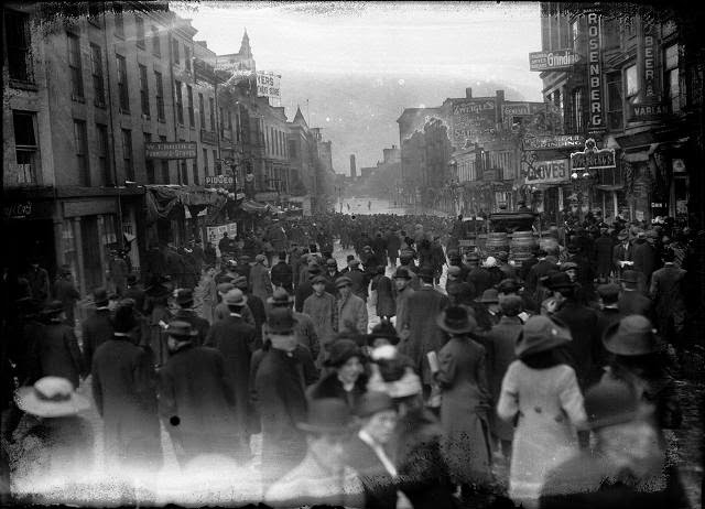
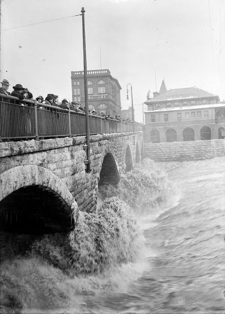
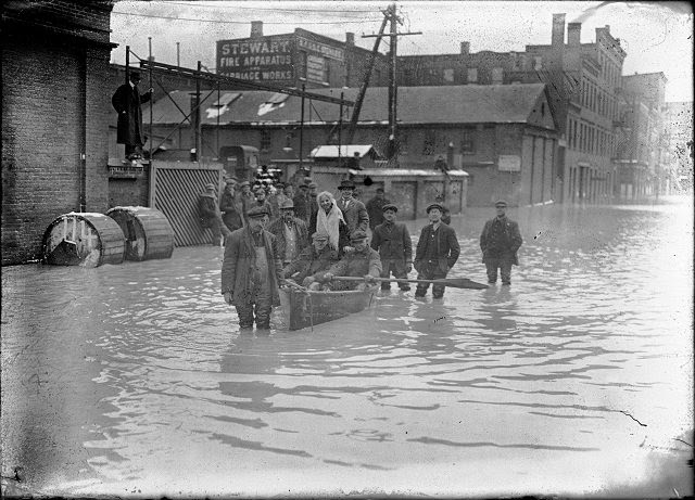
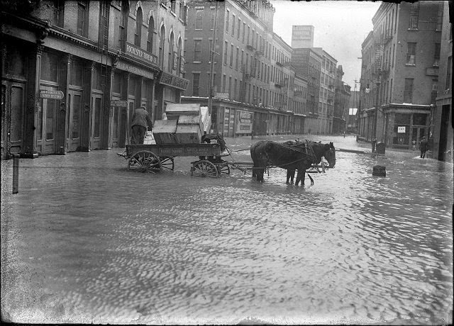
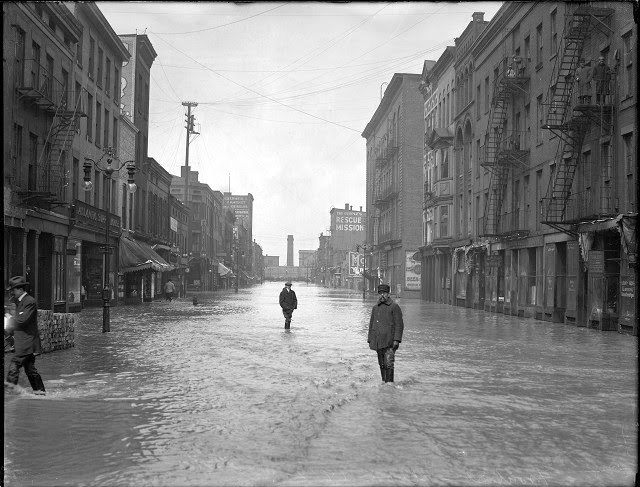
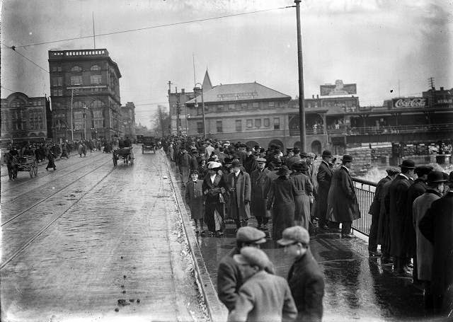
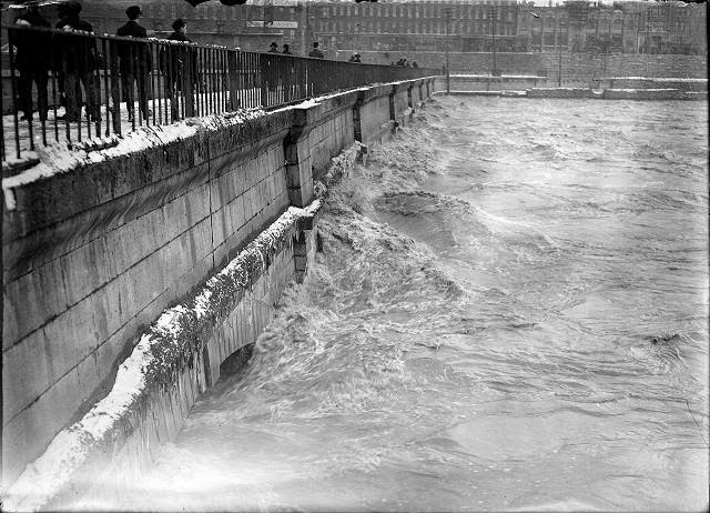
Below is a collection of 24 amazing vintage photographs of the Rochester’s Great Flood of 1913.
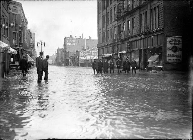
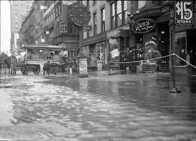
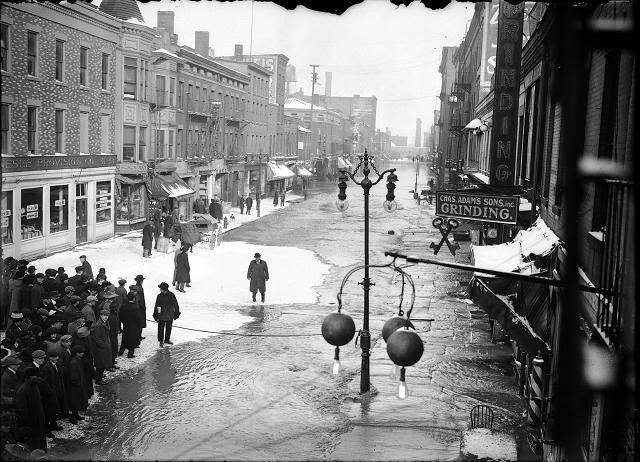
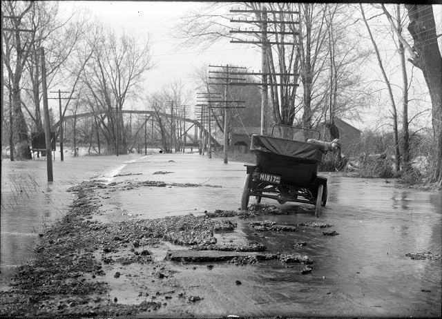
A large crowd is gathered on Front Street to look at the flood at the other end of the street. Varlan’s Hotel, Rosenberg’s Pawnshop, Charles Adam’s Sons Grinding, J.G. Zweigle’s Sons, W.T. Bridle Furniture, William Pigeon Shoes, Hyman Davis Shoes, Genesee Provision Company, Myers Department Store, and the F.H. Loeffler Company are visible in the photo. March, 1913Spectators line the Court Street Bridge railings to watch flood waters beating against the arches of the bridge, below the dam. March, 1913.A group of men are pictured in and around a rowboat on Front Street, during the flood of 1913. March, 1913.A group of people are pictured in and around a rowboat in the middle of flooded Front Street. They are members of a rescue crew that has saved a woman from a flooded building. All records for high water were broken in this flood. March, 1913.A Front Street policeman patrols his beat in a rowboat during the 1913 flood. He and another man row past the Hotel Richmond at the corner of Front and Market Streets. March, 1913.A horse and wagon stand in the middle of Mill Street during the 1913 flood. This is Mill Street at Andrews Street. Rochester Thread Company, F.A. Sherwood Company, John M. Forster Company, and Fahy Market are visible in the photo. March, 1913.Men are standing ankle-deep in water on Front Street. On the left is the Atlantic Supply House and on the right is the People’s Rescue Mission. March, 1913.Men stand ankle deep in flood water on Front Street. They are in front of the Rochester Poultry & Commission Company. The People’s Rescue Mission is in the background. March, 1913.Two men stand ankle-deep in water on Front Street. They are carrying a coffee pot and baskets. On the right side of the photograph a man and a woman look out of a doorway. March, 1913.Three men ride a rowboat down flooded Front Street. They are passing J.G. Zweigle’s. March, 1913.The flood has filled the store cellars with water on Main Street East at Graves Street. All the first floors are submerged as well. A horse and wagon are at the curb and the men are standing on the sidewalk. F.P. Van Hoesen Company, Rienzi (a bar), J.C. Wilson Company, the Postal Telegraph Cable Company, and the Fifth Avenue Clothes Shop are visible in the photo. March, 1913.Rochesterians viewing the water on Front Street. Ice has formed in pockets on the flooded street. The sign for Charles Adam’s Sons, Inc.Genesee River in high water stage, showing the backs of Front Street buildings. This is believed to be a depiction of the flood of March 28, 1913. Myer’s Department Store, Charles Adam (grinding), and Zweigle’s (sausage maker and saloon) are visible in the photo. Weis & Fisher Company (furniture and carpets) is in the right background at 297 Brown Street. The Powers Building tower is in the upper left corner. March, 1913.A group of people stand at the edge of the flood water on Front Street in front of the Genesee Provision Company. A rope cordons off the street near Charles Adam’s Grinding and the William H. Larkin Hotel. March, 1913.Two men are stopped in a Ford car during the flood on Front Street. One man is holding a camera and other men stand in the street in ankle-deep water. March, 1913.This view is a close-up of flood water going into the shops on Front Street. There is a Bartholomay Beer sign on the post. March, 1913.A man sits in a Ford automobile, which has water halfway up the wheels. This is Plymouth Avenue, which has been completely flooded by the Genesee River. March, 1913.The Durand boathouse in Genesee Valley Park shows major flood damage. The Genesee River, again peaceful, flows past it. March, 1913.A man leans out of a car to observe the damage done on River Road.People, including one man with a horse and buggy, stand at the edge of the flood on Front Street. Dave Solomon, Pawnbroker and Auctioneer; Charles Adam’s Sons, Incorporated, Grinding; Zweigle’s; and (probably) the Genesee Provision Company are visible in the photo. March, 1913.Men climb up a ladder from a rowboat to deliver food to families marooned on the upper floors of Rochester’s business section. The men are pictured in front of Jacob Goldstein’s Lodging House and J.C. Vine’s Columbia Hotel. March, 1913.Pedestrians throng the sidewalks of the Court Street Bridge to see the flood waters, as a few horse-driven carriages and automobiles drive past. March, 1913.Flood waters swirl around the aqueduct near Broad Street, looking toward South Avenue. March, 1913.Police hold back a large crowd at the water’s edge on flooded Front Street. March, 1913.